
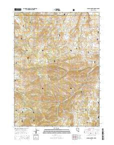
~ Hicks Mountain NV topo map, 1:24000 scale, 7.5 X 7.5 Minute, 2014
Hicks Mountain, Nevada, USGS topographic map dated 2014.
Includes geographic coordinates (latitude and longitude). This topographic map is suitable for hiking, camping, and exploring, or framing it as a wall map.
Printed on-demand using high resolution imagery, on heavy weight and acid free paper, or alternatively on a variety of synthetic materials.
Topos available on paper, Waterproof, Poly, or Tyvek. Usually shipping rolled, unless combined with other folded maps in one order.
- Product Number: USGS-7172588
- Free digital map download (high-resolution, GeoPDF): Hicks Mountain, Nevada (file size: 24 MB)
- Map Size: please refer to the dimensions of the GeoPDF map above
- Weight (paper map): ca. 55 grams
- Map Type: POD USGS Topographic Map
- Map Series: US Topo
- Map Verison: Current
- Cell ID: 20312
- Datum: North American Datum of 1983
- Map Projection: Transverse Mercator
- Map Cell Name: Hicks Mountain
- Grid size: 7.5 X 7.5 Minute
- Date on map: 2014
- Map Scale: 1:24000
- Geographical region: Nevada, United States
Neighboring Maps:
All neighboring USGS topo maps are available for sale online at a variety of scales.
Spatial coverage:
Topo map Hicks Mountain, Nevada, covers the geographical area associated the following places:
- Hicks Creek - Bruneau Range - Snowshoe Gulch - Salmon Spring - Copper Mountain - Corral Creek - Yankee Bill Summit - McDonalds Mine - Henry Spring - Pine Spring - McDonalds School House (historical) - Sagehen Basin - Schoolhouse Draw - Enright Hill - Hillside Spring - Badger Creek - Corral Springs Creek - Deadhorse Draw - Slaterock Creek - Clover Creek - Cold Springs - Hicks Mountain - Ditch Creek - Cowan Creek - Log Gulch - Blackbird Gulch - Little Alder Creek - Bruneau Ranch - Yankee Bill Flat - Trail Gulch - Mustang Butte - Rizzi Ranch - Alder Mountain - Alder Gulch - McKenzie Ranch - Little Cat Creek - Salmon Meadow - Summit Spring
- Map Area ID: AREA4241.875-115.875-115.75
- Northwest corner Lat/Long code: USGSNW42-115.875
- Northeast corner Lat/Long code: USGSNE42-115.75
- Southwest corner Lat/Long code: USGSSW41.875-115.875
- Southeast corner Lat/Long code: USGSSE41.875-115.75
- Northern map edge Latitude: 42
- Southern map edge Latitude: 41.875
- Western map edge Longitude: -115.875
- Eastern map edge Longitude: -115.75


