
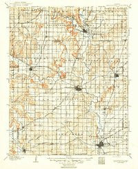
~ Independence KS topo map, 1:125000 scale, 30 X 30 Minute, Historical, 1905, updated 1949
Independence, Kansas, USGS topographic map dated 1905.
Includes geographic coordinates (latitude and longitude). This topographic map is suitable for hiking, camping, and exploring, or framing it as a wall map.
Printed on-demand using high resolution imagery, on heavy weight and acid free paper, or alternatively on a variety of synthetic materials.
Topos available on paper, Waterproof, Poly, or Tyvek. Usually shipping rolled, unless combined with other folded maps in one order.
- Product Number: USGS-6006704
- Free digital map download (high-resolution, GeoPDF): Independence, Kansas (file size: 6 MB)
- Map Size: please refer to the dimensions of the GeoPDF map above
- Weight (paper map): ca. 55 grams
- Map Type: POD USGS Topographic Map
- Map Series: HTMC
- Map Verison: Historical
- Cell ID: 65732
- Scan ID: 801798
- Imprint Year: 1949
- Survey Year: 1903
- Datum: Unstated
- Map Projection: Polyconic
- Map published by United States Geological Survey
- Map Language: English
- Scanner Resolution: 508 dpi
- Map Cell Name: Independence
- Grid size: 30 X 30 Minute
- Date on map: 1905
- Map Scale: 1:125000
- Geographical region: Kansas, United States
Neighboring Maps:
All neighboring USGS topo maps are available for sale online at a variety of scales.
Spatial coverage:
Topo map Independence, Kansas, covers the geographical area associated the following places:
- Sycamore - Buxton - Buffville - Bolton - Jefferson - West Coffeyville - Glendale Mobile Home Estates - Tyro - Liberty - Brookside Mobile Home Estates - Cherryvale - Caney - Blake - Lafontaine - Morehead - Neodesha - Crane - Avian - Wayside - Independence - Corbin (historical) - Coffeyville - Hilford - Le Hunt - Havana - Fruitland - Upola - Dearing - Elk City - Brooks
- Map Area ID: AREA37.537-96-95.5
- Northwest corner Lat/Long code: USGSNW37.5-96
- Northeast corner Lat/Long code: USGSNE37.5-95.5
- Southwest corner Lat/Long code: USGSSW37-96
- Southeast corner Lat/Long code: USGSSE37-95.5
- Northern map edge Latitude: 37.5
- Southern map edge Latitude: 37
- Western map edge Longitude: -96
- Eastern map edge Longitude: -95.5


