
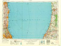
~ Racine WI topo map, 1:250000 scale, 1 X 2 Degree, Historical, 1958, updated 1971
Racine, Wisconsin, USGS topographic map dated 1958.
Includes geographic coordinates (latitude and longitude). This topographic map is suitable for hiking, camping, and exploring, or framing it as a wall map.
Printed on-demand using high resolution imagery, on heavy weight and acid free paper, or alternatively on a variety of synthetic materials.
Topos available on paper, Waterproof, Poly, or Tyvek. Usually shipping rolled, unless combined with other folded maps in one order.
- Product Number: USGS-6000098
- Free digital map download (high-resolution, GeoPDF): Racine, Wisconsin (file size: 13 MB)
- Map Size: please refer to the dimensions of the GeoPDF map above
- Weight (paper map): ca. 55 grams
- Map Type: POD USGS Topographic Map
- Map Series: HTMC
- Map Verison: Historical
- Cell ID: 68980
- Scan ID: 803021
- Imprint Year: 1971
- Woodland Tint: Yes
- Aerial Photo Year: 1956
- Edit Year: 1969
- Field Check Year: 1958
- Datum: Unstated
- Map Projection: Transverse Mercator
- Map published by United States Geological Survey
- Map Language: English
- Scanner Resolution: 508 dpi
- Map Cell Name: Racine
- Grid size: 1 X 2 Degree
- Date on map: 1958
- Map Scale: 1:250000
- Geographical region: Wisconsin, United States
Neighboring Maps:
All neighboring USGS topo maps are available for sale online at a variety of scales.
Spatial coverage:
Topo map Racine, Wisconsin, covers the geographical area associated the following places:
- Hollywood - Pleasant Prairie Mobile Home Court - Douglas - Siemar Subdivision - Lake Bluff - Timber Lane - Floral Terrace Estates - Rugen Subdivision - Glencoe - Maple Grove Corners - Coral Manor - Huntington - Husher - Clarke's Subdivision - Northbrook Park - Anetsberger's Subdivision - Briarwood Glen - Colonial Village - South Milwaukee - Sturtevant - Prairie View - Whispering Pines Estates and Mobile Home Park - The Grove - Half Day - Spinks Corners - Grace Manor - Solar Grove - Northbrook Manor - Stonegate - Orchard View Estates - Somers - Dunsten Green - New Holland - Winschester Lane North - Harris Corners - Timber Ridge - Robinson - Red Haw Ridge - Bachs Addition - Shermer Square - Buckhorn - Rozenow's Subdivision - Maple Island - Gages Lake - Levelview Acres - Macks Landing - Noordeloos - Hansen Subdivision - Northwood Edens - Skokie Manor - Buttonwood - Pier Cove - Cudahy - Ridgecroft - Porter Subdivision - Northbrook Villa - Little Paw Paw Lake - La Salceda Subdivision - Deerfield - Fair Acres - Miami Park - Kinswept Subdivision - Sunridge - Gross Point - Fritzburg - The Commons - Green Oaks - Harvest View Estates - Des Plaines - Picardy Circle - Kenosha - Spring Lake Mobile Home Park - Hubbard Woods - The Colonnades - Shoreham - Kings Landing - Ottogan Mobile Home Estates - Fish Corners - Bainbridge Center - Everett - Indian Creek - Ivy Club of Northbrook - Beechwood - Woodoaks Court - Northfield - Benton Center - Lake Forest - Woodridge - Charring Cross - Aptakisic - Lawrence Mobile Home Park - Agnew - Lee Woods - Fournins Subdivision - Harlem - Bannockburn - Paw Paw Lake - Winnetka - Dean-Horsch Subdivision - Riverwoods
- Map Area ID: AREA4342-88-86
- Northwest corner Lat/Long code: USGSNW43-88
- Northeast corner Lat/Long code: USGSNE43-86
- Southwest corner Lat/Long code: USGSSW42-88
- Southeast corner Lat/Long code: USGSSE42-86
- Northern map edge Latitude: 43
- Southern map edge Latitude: 42
- Western map edge Longitude: -88
- Eastern map edge Longitude: -86


