
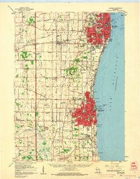
~ Racine WI topo map, 1:62500 scale, 15 X 15 Minute, Historical, 1959, updated 1960
Racine, Wisconsin, USGS topographic map dated 1959.
Includes geographic coordinates (latitude and longitude). This topographic map is suitable for hiking, camping, and exploring, or framing it as a wall map.
Printed on-demand using high resolution imagery, on heavy weight and acid free paper, or alternatively on a variety of synthetic materials.
Topos available on paper, Waterproof, Poly, or Tyvek. Usually shipping rolled, unless combined with other folded maps in one order.
- Product Number: USGS-6000080
- Free digital map download (high-resolution, GeoPDF): Racine, Wisconsin (file size: 5 MB)
- Map Size: please refer to the dimensions of the GeoPDF map above
- Weight (paper map): ca. 55 grams
- Map Type: POD USGS Topographic Map
- Map Series: HTMC
- Map Verison: Historical
- Cell ID: 61410
- Scan ID: 503485
- Imprint Year: 1960
- Woodland Tint: Yes
- Aerial Photo Year: 1955
- Datum: NAD27
- Map Projection: Polyconic
- Map published by United States Geological Survey
- Map Language: English
- Scanner Resolution: 508 dpi
- Map Cell Name: Racine
- Grid size: 15 X 15 Minute
- Date on map: 1959
- Map Scale: 1:62500
- Geographical region: Wisconsin, United States
Neighboring Maps:
All neighboring USGS topo maps are available for sale online at a variety of scales.
Spatial coverage:
Topo map Racine, Wisconsin, covers the geographical area associated the following places:
- Westwood Estates - Mount Pleasant - Kenosha - Prairie Lake Estates - City View Mobile Home Community - Harvest View Estates - Timber Ridge - Waxdale - Sturtevant - Racine - South Kenosha - Tobin - Oakdale Estates - Alpine Village Mobile Home Park - Pleasant Prairie Mobile Home Court - Ives Grove - Maple Lane Mobile Home Park - Oakwood Mobile Home Community - Pleasant Prairie - Shorecrest Pointe - Alfords Park Mobile Homes Court - Jensen's Mobile Home Village - Carol Beach - Somers - Sylvania - Truesdell - Elmwood Park
- Map Area ID: AREA42.7542.5-88-87.75
- Northwest corner Lat/Long code: USGSNW42.75-88
- Northeast corner Lat/Long code: USGSNE42.75-87.75
- Southwest corner Lat/Long code: USGSSW42.5-88
- Southeast corner Lat/Long code: USGSSE42.5-87.75
- Northern map edge Latitude: 42.75
- Southern map edge Latitude: 42.5
- Western map edge Longitude: -88
- Eastern map edge Longitude: -87.75


