
~ Madeline Island WI topo map, 1:62500 scale, 15 X 15 Minute, Historical, 1964, updated 1980
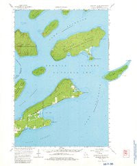
Madeline Island, Wisconsin, USGS topographic map dated 1964.
Includes geographic coordinates (latitude and longitude). This topographic map is suitable for hiking, camping, and exploring, or framing it as a wall map.
Printed on-demand using high resolution imagery, on heavy weight and acid free paper, or alternatively on a variety of synthetic materials.
Topos available on paper, Waterproof, Poly, or Tyvek. Usually shipping rolled, unless combined with other folded maps in one order.
- Product Number: USGS-5998956
- Free digital map download (high-resolution, GeoPDF): Madeline Island, Wisconsin (file size: 6 MB)
- Map Size: please refer to the dimensions of the GeoPDF map above
- Weight (paper map): ca. 55 grams
- Map Type: POD USGS Topographic Map
- Map Series: HTMC
- Map Verison: Historical
- Cell ID: 57029
- Scan ID: 503356
- Imprint Year: 1980
- Woodland Tint: Yes
- Datum: NAD27
- Map Projection: Polyconic
- Map published by United States Geological Survey
- Keywords: Overedge
- Map Language: English
- Scanner Resolution: 508 dpi
- Map Cell Name: Madeline Island
- Grid size: 15 X 15 Minute
- Date on map: 1964
- Map Scale: 1:62500
- Geographical region: Wisconsin, United States
Neighboring Maps:
All neighboring USGS topo maps are available for sale online at a variety of scales.
Spatial coverage:
Topo map Madeline Island, Wisconsin, covers the geographical area associated the following places:
- Big Bay Sand Spit And Bog State Natural Area - Basswood Island - Trout Point - Hermit Island - Madeline Island - Amnicon Point - Bog Lake - North Channel - Quarry Bay - Apostle Islands - Otter Island - Gaylord Nelson Wilderness - Manitou Island - Presque Isle Point - South Channel - Big Bay Point - Stockton Island - Clay Banks - Oak Island Shoal - Amnicon Bay - Big Bay Lagoon - Devils Cauldron - Steamboat Point - Apostle Islands State Forest - Big Bay - Greenwood Cemetery - Chebomnicon Bay - Presque Isle Bay - Apostle Islands National Lakeshore - Balancing Rock - Sunset Bay - Town of La Pointe - Big Bay State Park - Manitou Camp - Quarry Point - Oak Island
- Map Area ID: AREA4746.75-90.75-90.5
- Northwest corner Lat/Long code: USGSNW47-90.75
- Northeast corner Lat/Long code: USGSNE47-90.5
- Southwest corner Lat/Long code: USGSSW46.75-90.75
- Southeast corner Lat/Long code: USGSSE46.75-90.5
- Northern map edge Latitude: 47
- Southern map edge Latitude: 46.75
- Western map edge Longitude: -90.75
- Eastern map edge Longitude: -90.5


