
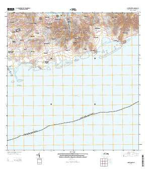
~ Christiansted VI topo map, 1:20000 scale, 7.5 X 7.5 Minute, Historical, 2013
Christiansted, Virgin Islands, USGS topographic map dated 2013.
Includes geographic coordinates (latitude and longitude). This topographic map is suitable for hiking, camping, and exploring, or framing it as a wall map.
Printed on-demand using high resolution imagery, on heavy weight and acid free paper, or alternatively on a variety of synthetic materials.
Topos available on paper, Waterproof, Poly, or Tyvek. Usually shipping rolled, unless combined with other folded maps in one order.
- Product Number: USGS-5964378
- Free digital map download (high-resolution, GeoPDF): Christiansted, Virgin Islands (file size: 26 MB)
- Map Size: please refer to the dimensions of the GeoPDF map above
- Weight (paper map): ca. 55 grams
- Map Type: POD USGS Topographic Map
- Map Series: US Topo
- Map Verison: Historical
- Cell ID: 332169
- Datum: North American Datum of 1983
- Map Projection: Transverse Mercator
- Map Cell Name: Christiansted
- Grid size: 7.5 X 7.5 Minute
- Date on map: 2013
- Map Scale: 1:20000
- Geographical region: Virgin Islands, United States
Neighboring Maps:
All neighboring USGS topo maps are available for sale online at a variety of scales.
Spatial coverage:
Topo map Christiansted, Virgin Islands, covers the geographical area associated the following places:
- Christiansted - Cotton Grove - Pearl - Bulows Minde - Petronella - Grange - Cathrines Rest - Recovery Hill - Alderhvile (historical) - Nugent - Diamond Keturah - Great Pond - Peters Rest - Ryan - Bugbyhole - Fareham - Beeston Hill - Orange Grove - Contentment - Humbug - Altona - Munster - Lowrys Hill - Annas Hope - Granard - Sunny Isle - Richmond - Butzberg - Saint Peter - Bellevue - Fredensdal - Sallys Fancy - Longford - Sion Hill - Seven Hills - Castle Coakley - Sion Farm - Laprey Valley
- Map Area ID: AREA17.7517.625-64.75-64.625
- Northwest corner Lat/Long code: USGSNW17.75-64.75
- Northeast corner Lat/Long code: USGSNE17.75-64.625
- Southwest corner Lat/Long code: USGSSW17.625-64.75
- Southeast corner Lat/Long code: USGSSE17.625-64.625
- Northern map edge Latitude: 17.75
- Southern map edge Latitude: 17.625
- Western map edge Longitude: -64.75
- Eastern map edge Longitude: -64.625


