
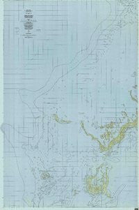
~ Chelbacheb PW topo map, 1:25000 scale, 7.5 X 7.5 Minute, Historical, 1984, updated 1984
Chelbacheb, Republic of Palau, USGS topographic map dated 1984.
Includes geographic coordinates (latitude and longitude). This topographic map is suitable for hiking, camping, and exploring, or framing it as a wall map.
Printed on-demand using high resolution imagery, on heavy weight and acid free paper, or alternatively on a variety of synthetic materials.
Topos available on paper, Waterproof, Poly, or Tyvek. Usually shipping rolled, unless combined with other folded maps in one order.
- Product Number: USGS-5948445
- Free digital map download (high-resolution, GeoPDF): Chelbacheb, Republic of Palau (file size: 59 MB)
- Map Size: please refer to the dimensions of the GeoPDF map above
- Weight (paper map): ca. 55 grams
- Map Type: POD USGS Topographic Map
- Map Series: HTMC
- Map Verison: Historical
- Cell ID: 76706
- Scan ID: 463191
- Imprint Year: 1984
- Woodland Tint: Yes
- Aerial Photo Year: 1971
- Edit Year: 1984
- Field Check Year: 1980
- Datum: Guam 1963
- Map Projection: Universal Transverse Mercator
- Map published by United States Geological Survey
- Keywords: Overedge with No Adjacent Map
- Map Language: English
- Scanner Resolution: 480 dpi
- Map Cell Name: Chelbacheb
- Grid size: 7.5 X 7.5 Minute
- Date on map: 1984
- Map Scale: 1:25000
- Geographical region: Republic of Palau, United States
Neighboring Maps:
All neighboring USGS topo maps are available for sale online at a variety of scales.
Spatial coverage:
Topo map Chelbacheb, Republic of Palau, covers the geographical area associated the following places:
- Belual A Kelat - Kobasang Harbor - Bkulchongelibel - Ngerdiluches - Daerur - Bkul A Chesemiich - Mecherchar - Biduul - Bkul A Techedoched - Ngebedangel - Bkul A Ngerkebeas - Mesikm - Kemokem - Ngeanges - Eil Malk - Oilouch - Ngesomel - Mutkebesang - Ongingiang - Urecheruchel - Butiaur - Ngermeaus - Bkul A Ngebedanget - Chelbacheb - Ngkesill - Oimadelchesuch - Bkul A Ngchus - Kuabesngas - Sebeseb - Bablomekang - Apurashokoru - Toachel Iou - Ngertachuel - Ngerur - Edchib - Ngchus - Sar Passage - Tlutkaraguis - Ii Ra Omdakel - Ongetkatel - Uchel A Rois - Rirs Bital - Ngelsibel - Chudel - Ngemlis - Denges - Ngermerand - Metukeruikull - Ngerukewid Islands Wildlife Preserve - Chemol - Englishmens Beach - Rikelau - Ngebedel - Metkerel A Ikesul - Cheuedlochel - Ngeruktabel - Ngerumekaul - Kekereiel Toi - Desomel - Ngerutekill - Ongael - Euidelchol - Ngerukewid - Ongalkereel - Ioulomekang - Kmekumer - Ngerusisech - Terrangel - Ngecholobel - Mchochaeo - Chouwid - Bkulomekerall - Chomedokl - German Channel - Kuabeserrai - Emesiochel - Kltaltebechel - Ngeremekediu - Dmasech - Klouel Toi - Ulong - Arishoku - Ngis - Bkulsechuul - Iilblau - Demul Iou - Beab - Ngeroleamel - Beduliases - Toachel Belau - State of Koror - Ngkael
- Map Area ID: AREA7.57.1166667134.1833333134.4333333
- Northwest corner Lat/Long code: USGSNW7.5134.1833333
- Northeast corner Lat/Long code: USGSNE7.5134.4333333
- Southwest corner Lat/Long code: USGSSW7.1166667134.1833333
- Southeast corner Lat/Long code: USGSSE7.1166667134.4333333
- Northern map edge Latitude: 7.5
- Southern map edge Latitude: 7.1166667
- Western map edge Longitude: 134.1833333
- Eastern map edge Longitude: 134.4333333


