
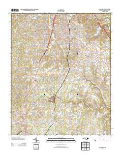
~ Sanford NC topo map, 1:24000 scale, 7.5 X 7.5 Minute, Historical, 2013
Sanford, North Carolina, USGS topographic map dated 2013.
Includes geographic coordinates (latitude and longitude). This topographic map is suitable for hiking, camping, and exploring, or framing it as a wall map.
Printed on-demand using high resolution imagery, on heavy weight and acid free paper, or alternatively on a variety of synthetic materials.
Topos available on paper, Waterproof, Poly, or Tyvek. Usually shipping rolled, unless combined with other folded maps in one order.
- Product Number: USGS-5945581
- Free digital map download (high-resolution, GeoPDF): Sanford, North Carolina (file size: 35 MB)
- Map Size: please refer to the dimensions of the GeoPDF map above
- Weight (paper map): ca. 55 grams
- Map Type: POD USGS Topographic Map
- Map Series: US Topo
- Map Verison: Historical
- Cell ID: 39851
- Datum: North American Datum of 1983
- Map Projection: Transverse Mercator
- Map Cell Name: Sanford
- Grid size: 7.5 X 7.5 Minute
- Date on map: 2013
- Map Scale: 1:24000
- Geographical region: North Carolina, United States
Neighboring Maps:
All neighboring USGS topo maps are available for sale online at a variety of scales.
Spatial coverage:
Topo map Sanford, North Carolina, covers the geographical area associated the following places:
- Planters Ridge - Brookhaven - Owls Nest - Parkwood Estates - Sunset Terrace - Courtland Acres - San-Lee Park - Sanford - Clearwater Forest - Western Hills - Royal Oaks - Colonial Acres - Brookwood - Brentwood - Berkley Place - Woodbridge - Trails End - Saint Andrews - Cool Springs - Lemon Springs - Carbonton Heights - McCracken Heights - Longview Acres - Meadow Park - Quail Ridge - Hanover Circle - Jonesboro Heights - Westcroft - Kendall Acres - Country Lane Estates - West Lake Valley - Tramway
- Map Area ID: AREA35.535.375-79.25-79.125
- Northwest corner Lat/Long code: USGSNW35.5-79.25
- Northeast corner Lat/Long code: USGSNE35.5-79.125
- Southwest corner Lat/Long code: USGSSW35.375-79.25
- Southeast corner Lat/Long code: USGSSE35.375-79.125
- Northern map edge Latitude: 35.5
- Southern map edge Latitude: 35.375
- Western map edge Longitude: -79.25
- Eastern map edge Longitude: -79.125


