
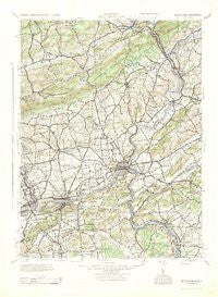
~ Bethlehem PA topo map, 1:125000 scale, 30 X 30 Minute, Historical, 1943
Bethlehem, Pennsylvania, USGS topographic map dated 1943.
Includes geographic coordinates (latitude and longitude). This topographic map is suitable for hiking, camping, and exploring, or framing it as a wall map.
Printed on-demand using high resolution imagery, on heavy weight and acid free paper, or alternatively on a variety of synthetic materials.
Topos available on paper, Waterproof, Poly, or Tyvek. Usually shipping rolled, unless combined with other folded maps in one order.
- Product Number: USGS-5930977
- Free digital map download (high-resolution, GeoPDF): Bethlehem, Pennsylvania (file size: 8 MB)
- Map Size: please refer to the dimensions of the GeoPDF map above
- Weight (paper map): ca. 55 grams
- Map Type: POD USGS Topographic Map
- Map Series: HTMC
- Map Verison: Historical
- Cell ID: 64990
- Scan ID: 461641
- Woodland Tint: Yes
- Datum: NAD27
- Map Projection: Polyconic
- Map published by United States Army Corps of Engineers
- Map published by United States Army
- Map published by United States Department of War
- Map Language: English
- Scanner Resolution: 600 dpi
- Map Cell Name: Bethlehem
- Grid size: 30 X 30 Minute
- Date on map: 1943
- Map Scale: 1:125000
- Geographical region: Pennsylvania, United States
Neighboring Maps:
All neighboring USGS topo maps are available for sale online at a variety of scales.
Spatial coverage:
Topo map Bethlehem, Pennsylvania, covers the geographical area associated the following places:
- Everittstown - Marshfield Station - Saucon - Newburg Homes - Hellertown - Revere - McMichael - Kemmererville - Chestnut Hill - Rocky Valley - West Catasauqua - Passer - Emanuelsville - Fullerton - Limeport - Walters - Buttzville - Stormville - Boulton - Bloomsbury - Juniper Circle - Monroe - East Lawn - Blue Mountain Pines - Sandts Eddy - Prospect Park - Filetown - Penn Allen - Sciota - Clyde - Delaware - Jackson - Pattenburg - Brownings - Kennedys - Gauff Hill - Summerfield - Chestnut Ridge Acres - Vera Cruz - Old Orchard - Appenzell - Westgate Hills - New Village - Frenchtown - Catasauqua - Northwood Heights - Tadmor - Weaversville - Hanoverville - East Hills - Arndts - Broadway - Stewartsville - Pahaquarry - Chapman - Hazen - Pen Argyl - Riegelsville - Shimerville - Schoenersville - Flicksville - Nazareth - Uhlersville (historical) - Beersville - Amsterdam - Roxburg - Star Village - Fountain Hill - Milford - Merwinsburg - Georgetown - Golden Acres Estates - West Portal - Lodi - Saucona - Coopersburg - New Village - Durham - Overlook Springs - Specktown - Knowlton - Fiddletown - Shimer - Bridgeville - Gilbert - Narrowsville - Belvidere - Stone Church - Rossland - Durham Furnace - Montana - Newburg - Leithsville - Kesslersville - Kingswood Estates - Northampton - Seidersville - Jamesville - Churchville - Columbia
- Map Area ID: AREA4140.5-75.5-75
- Northwest corner Lat/Long code: USGSNW41-75.5
- Northeast corner Lat/Long code: USGSNE41-75
- Southwest corner Lat/Long code: USGSSW40.5-75.5
- Southeast corner Lat/Long code: USGSSE40.5-75
- Northern map edge Latitude: 41
- Southern map edge Latitude: 40.5
- Western map edge Longitude: -75.5
- Eastern map edge Longitude: -75


