
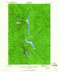
~ Umsaskis Lake ME topo map, 1:62500 scale, 15 X 15 Minute, Historical, 1932, updated 1961
Umsaskis Lake, Maine, USGS topographic map dated 1932.
Includes geographic coordinates (latitude and longitude). This topographic map is suitable for hiking, camping, and exploring, or framing it as a wall map.
Printed on-demand using high resolution imagery, on heavy weight and acid free paper, or alternatively on a variety of synthetic materials.
Topos available on paper, Waterproof, Poly, or Tyvek. Usually shipping rolled, unless combined with other folded maps in one order.
- Product Number: USGS-5685357
- Free digital map download (high-resolution, GeoPDF): Umsaskis Lake, Maine (file size: 9 MB)
- Map Size: please refer to the dimensions of the GeoPDF map above
- Weight (paper map): ca. 55 grams
- Map Type: POD USGS Topographic Map
- Map Series: HTMC
- Map Verison: Historical
- Cell ID: 63874
- Scan ID: 460977
- Imprint Year: 1961
- Woodland Tint: Yes
- Survey Year: 1932
- Datum: Unstated
- Map Projection: Polyconic
- Map published by United States Geological Survey
- Map Language: English
- Scanner Resolution: 600 dpi
- Map Cell Name: Umsaskis Lake
- Grid size: 15 X 15 Minute
- Date on map: 1932
- Map Scale: 1:62500
- Geographical region: Maine, United States
Neighboring Maps:
All neighboring USGS topo maps are available for sale online at a variety of scales.
Spatial coverage:
Topo map Umsaskis Lake, Maine, covers the geographical area associated the following places:
- Cunliffe Brook - Priestly Mountain - Priestly Brook - North Branch Glazier Brook - Glazier Brook - Glazier Pond - T11 R12 WELS - Holmes Brook - Poulins Camp - The Thoroughfare - Cunliffe Islands - Shepherd Brook - Gilbert Brook - Cunliffe Lake - Shepherd Pond - Grey Brook - T10 R13 WELS - Umsaskis Lake - Glazier Pond Brook - Squirrel Mountain - West Branch Drake Brook - Threemile Pond - Long Lake - Fire Warden Camp - Glazier Brook Mountain - Whitaker Brook - Kellys Camp - Vellieur Pond - Harding Brook - Caron Brook - Harvey Brook - Grey Brook Mountain - Harvey Pond - T12 R12 WELS - Grey Pond - Sweeney Pond - American Realty Depot Camp - T11 R13 WELS - Priestly Lake - Squirrel Brook - Drake Brook - Harding Brook Ridge - Paquette School - Little Churchill Pond - Harvey Farm - T10 R12 WELS - Long Lake Dam - Blanchette Camp - Chase Carry - T12 R13 WELS - Harrow Brook - Chemquasabamticook Stream - Sweeney Brook
- Map Area ID: AREA46.7546.5-69.5-69.25
- Northwest corner Lat/Long code: USGSNW46.75-69.5
- Northeast corner Lat/Long code: USGSNE46.75-69.25
- Southwest corner Lat/Long code: USGSSW46.5-69.5
- Southeast corner Lat/Long code: USGSSE46.5-69.25
- Northern map edge Latitude: 46.75
- Southern map edge Latitude: 46.5
- Western map edge Longitude: -69.5
- Eastern map edge Longitude: -69.25


