
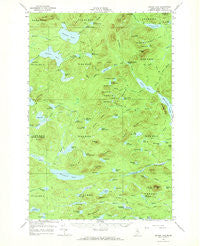
~ Spider Lake ME topo map, 1:62500 scale, 15 X 15 Minute, Historical, 1961, updated 1970
Spider Lake, Maine, USGS topographic map dated 1961.
Includes geographic coordinates (latitude and longitude). This topographic map is suitable for hiking, camping, and exploring, or framing it as a wall map.
Printed on-demand using high resolution imagery, on heavy weight and acid free paper, or alternatively on a variety of synthetic materials.
Topos available on paper, Waterproof, Poly, or Tyvek. Usually shipping rolled, unless combined with other folded maps in one order.
- Product Number: USGS-5685217
- Free digital map download (high-resolution, GeoPDF): Spider Lake, Maine (file size: 8 MB)
- Map Size: please refer to the dimensions of the GeoPDF map above
- Weight (paper map): ca. 55 grams
- Map Type: POD USGS Topographic Map
- Map Series: HTMC
- Map Verison: Historical
- Cell ID: 62841
- Scan ID: 460905
- Imprint Year: 1970
- Woodland Tint: Yes
- Aerial Photo Year: 1958
- Field Check Year: 1961
- Datum: NAD27
- Map Projection: Polyconic
- Map published by United States Geological Survey
- Map Language: English
- Scanner Resolution: 600 dpi
- Map Cell Name: Spider Lake
- Grid size: 15 X 15 Minute
- Date on map: 1961
- Map Scale: 1:62500
- Geographical region: Maine, United States
Neighboring Maps:
All neighboring USGS topo maps are available for sale online at a variety of scales.
Spatial coverage:
Topo map Spider Lake, Maine, covers the geographical area associated the following places:
- Snake Brook - Black Spruce Pond - T8 R11 WELS - Woodman Pond - Little Hudson Pond - Stink Pond - Chase Brook - Little Ragged Pond - Upper Bluffer Pond - Matthews Pond - Munsungan Ridge - Cliff Lake - South Branch Soper Brook - First Currier Brook - Ragged Brook - Snake Bog - Pleasant Lake - Upper Deadwater Pond - Island Pond Brook - Lower Partridge Pond - Haymock Mountain - Cedar Pond - Line Pond Mountain - Chandler Pond - Norway Brook - Buckley Pond - Little Bluffer Pond - Echo Lake - Big Reed Pond - Partridge Pond - Upper Soper Pond - Fifth Currier Pond - Bluffer Brook - Haymock Lake - Munsungan Brook - Little Ragged Mountain - Leadbetter Pond - Lower Deadwater Pond - Little Bluffer Brook - May Brook - Snowshoe Pond - Reed Brook - T9 R10 WELS - Beetle Mountain - Second Currier Brook - East Branch Atkins Brook - Pleasant Mountain - Upper Moose Pond - Grant Mountain - Currier Brook - Allen Mountain - May Pond - Blackmore Pond - Echo Ridge - Harrow Mountain - Upper Portage Pond - Little Reed Pond - Pillsbury Mountain - T7 R11 WELS - Atkins Brook - Spring Pond - Grass Pond - North Branch Echo Brook - North Branch Soper Brook - Spider Lake - Third Currier Pond - Little Indian Pond - Ragged Mountain - East Branch Deadwater - Carpenter Pond - Ragged Pond - Reed Mountain - Carpenter Mountain - Fourth Currier Pond - Peaked Mountain - South Branch Echo Brook - Pretty Pond - Snowshoe Mountain - Lower Portage Pond - East Branch Ridge - Fifth Currier Brook - Hay Pond - Soper Pond - Pillsbury Pond - T9 R11 WELS - West Branch Atkins Brook - Upper Partridge Pond - Sewall Deadwater Pond - Thirtyfoot Falls - Buckley Brook - First Currier Pond - Little Pillsbury Pond - Line Pond - Chase Lake - Echo Brook - Fourth Lake - Sixth Currier Pond - East Branch Pond - Island Pond - Chandler Brook Deadwater
- Map Area ID: AREA46.546.25-69.25-69
- Northwest corner Lat/Long code: USGSNW46.5-69.25
- Northeast corner Lat/Long code: USGSNE46.5-69
- Southwest corner Lat/Long code: USGSSW46.25-69.25
- Southeast corner Lat/Long code: USGSSE46.25-69
- Northern map edge Latitude: 46.5
- Southern map edge Latitude: 46.25
- Western map edge Longitude: -69.25
- Eastern map edge Longitude: -69


