
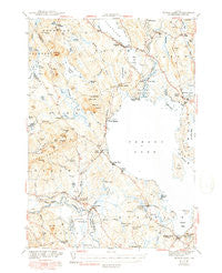
~ Sebago Lake ME topo map, 1:62500 scale, 15 X 15 Minute, Historical, 1943, updated 1949
Sebago Lake, Maine, USGS topographic map dated 1943.
Includes geographic coordinates (latitude and longitude). This topographic map is suitable for hiking, camping, and exploring, or framing it as a wall map.
Printed on-demand using high resolution imagery, on heavy weight and acid free paper, or alternatively on a variety of synthetic materials.
Topos available on paper, Waterproof, Poly, or Tyvek. Usually shipping rolled, unless combined with other folded maps in one order.
- Product Number: USGS-5685101
- Free digital map download (high-resolution, GeoPDF): Sebago Lake, Maine (file size: 7 MB)
- Map Size: please refer to the dimensions of the GeoPDF map above
- Weight (paper map): ca. 55 grams
- Map Type: POD USGS Topographic Map
- Map Series: HTMC
- Map Verison: Historical
- Cell ID: 62238
- Scan ID: 460848
- Imprint Year: 1949
- Survey Year: 1942
- Datum: NAD27
- Map Projection: Polyconic
- Map published by United States Geological Survey
- Map published by United States Army Corps of Engineers
- Map published by United States Department of War
- Map Language: English
- Scanner Resolution: 600 dpi
- Map Cell Name: Sebago Lake
- Grid size: 15 X 15 Minute
- Date on map: 1943
- Map Scale: 1:62500
- Geographical region: Maine, United States
Neighboring Maps:
All neighboring USGS topo maps are available for sale online at a variety of scales.
Spatial coverage:
Topo map Sebago Lake, Maine, covers the geographical area associated the following places:
- Harmon Beach - Long Beach - East Baldwin Mattocks Station - East Sebago - North Sebago - Pike Corner - South Casco - Kimballs Corner - Naples - Frye Island - Cook Mills - Sebago Lake - Convene - Douglas Hill - Wards Cove - Ruin Corner - Steep Falls - Ingalls - Edes Falls - Richville - Hillside - South Naples - West Sebago - Songo Lock - South Bridgton - Sebago Center - North Baldwin - Macs Corner
- Map Area ID: AREA4443.75-70.75-70.5
- Northwest corner Lat/Long code: USGSNW44-70.75
- Northeast corner Lat/Long code: USGSNE44-70.5
- Southwest corner Lat/Long code: USGSSW43.75-70.75
- Southeast corner Lat/Long code: USGSSE43.75-70.5
- Northern map edge Latitude: 44
- Southern map edge Latitude: 43.75
- Western map edge Longitude: -70.75
- Eastern map edge Longitude: -70.5


