
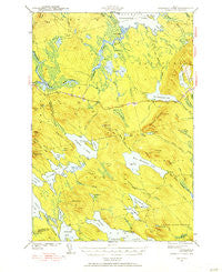
~ Scraggly Lake ME topo map, 1:62500 scale, 15 X 15 Minute, Historical, 1941
Scraggly Lake, Maine, USGS topographic map dated 1941.
Includes geographic coordinates (latitude and longitude). This topographic map is suitable for hiking, camping, and exploring, or framing it as a wall map.
Printed on-demand using high resolution imagery, on heavy weight and acid free paper, or alternatively on a variety of synthetic materials.
Topos available on paper, Waterproof, Poly, or Tyvek. Usually shipping rolled, unless combined with other folded maps in one order.
- Product Number: USGS-5685093
- Free digital map download (high-resolution, GeoPDF): Scraggly Lake, Maine (file size: 8 MB)
- Map Size: please refer to the dimensions of the GeoPDF map above
- Weight (paper map): ca. 55 grams
- Map Type: POD USGS Topographic Map
- Map Series: HTMC
- Map Verison: Historical
- Cell ID: 62221
- Scan ID: 460842
- Woodland Tint: Yes
- Survey Year: 1941
- Datum: NAD27
- Map Projection: Polyconic
- Map published by United States Geological Survey
- Map published by United States Army Corps of Engineers
- Map Language: English
- Scanner Resolution: 600 dpi
- Map Cell Name: Scraggly Lake
- Grid size: 15 X 15 Minute
- Date on map: 1941
- Map Scale: 1:62500
- Geographical region: Maine, United States
Neighboring Maps:
All neighboring USGS topo maps are available for sale online at a variety of scales.
Spatial coverage:
Topo map Scraggly Lake, Maine, covers the geographical area associated the following places:
- Pleasant Lake - Penobscot Bald Mountain - Foster Brook - Whitney Cove Mountain - Middle Deadwater - Dipper Pond - Upper Flood Lake - Pineo Point - T6 R1 NBPP - Musquash Mountain - Town of Topsfield - Trout Lake - Stuart Brook - Unorganized Territory of Whitney - Pug Lake - East Musquash Lake - Whitney Cove - Sweet Brook - Long Island - Oxbrook Stream - Rainey Brook - Tolman Deadwater - Kossuth Township - Horsehill Brook - Farrow Mountain - Junior Stream - Orie Lake Stream - Bailey Brook - Brooks and Walden Brook - Pukakon Township - Gentner Cove - Upper Oxbrook Lake - Vinegar Hill - Doren Brook - Dill Hill - Orie Lake - Sweet Cove - Pleasant Lake Ridge - Shaw Lake - Town of Talmadge - Big Bog - Shaw Lake Ridge - Caribou Bog - Pineo Mountains - Dark Cove - Mud Cove - Farrow Lake - Musquash Cove - Horse Hill Brook - Porcupine Mountain - Junior Bay - Amazon Lake - Alder Brook - Pickerel Pond - West Musquash Lake - Flood Lake - Crabtree Bog - Scraggly Lake - Deadman Bog - Birch Point - Lindsey Brook - Mount Delight - Flood Brook - Lake Rips - Bradford Valley - Pork Barrel Lake - Woodcock Brook - The Thorofare - Wallace Brook - Trout Lake Stream - Black Cat Rips - Baskahegan Stream - Horse Hill - Trout Lake Ridge - Princeton Island - Day Cove - Jenkins Brook - Pleasant Brook - Pine Island - Alder Brook Swamp - Lower Oxbrook Lake - Pickerel Pond - Denver Brook - West Branch Amazon Brook - Tracy Mountain - Norway Lake - Bear Mountain
- Map Area ID: AREA45.545.25-68-67.75
- Northwest corner Lat/Long code: USGSNW45.5-68
- Northeast corner Lat/Long code: USGSNE45.5-67.75
- Southwest corner Lat/Long code: USGSSW45.25-68
- Southeast corner Lat/Long code: USGSSE45.25-67.75
- Northern map edge Latitude: 45.5
- Southern map edge Latitude: 45.25
- Western map edge Longitude: -68
- Eastern map edge Longitude: -67.75


