
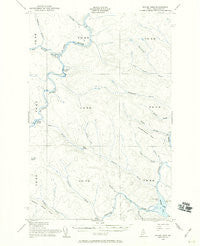
~ Round Pond ME topo map, 1:62500 scale, 15 X 15 Minute, Historical, 1955, updated 1960
Round Pond, Maine, USGS topographic map dated 1955.
Includes geographic coordinates (latitude and longitude). This topographic map is suitable for hiking, camping, and exploring, or framing it as a wall map.
Printed on-demand using high resolution imagery, on heavy weight and acid free paper, or alternatively on a variety of synthetic materials.
Topos available on paper, Waterproof, Poly, or Tyvek. Usually shipping rolled, unless combined with other folded maps in one order.
- Product Number: USGS-5685039
- Free digital map download (high-resolution, GeoPDF): Round Pond, Maine (file size: 6 MB)
- Map Size: please refer to the dimensions of the GeoPDF map above
- Weight (paper map): ca. 55 grams
- Map Type: POD USGS Topographic Map
- Map Series: HTMC
- Map Verison: Historical
- Cell ID: 61766
- Scan ID: 460815
- Imprint Year: 1960
- Visual Version Number: 1
- Aerial Photo Year: 1952
- Field Check Year: 1955
- Datum: NAD27
- Map Projection: Polyconic
- Map published by United States Geological Survey
- Map published by United States Army Corps of Engineers
- Map published by United States Army
- Map Language: English
- Scanner Resolution: 600 dpi
- Map Cell Name: Round Pond
- Grid size: 15 X 15 Minute
- Date on map: 1955
- Map Scale: 1:62500
- Geographical region: Maine, United States
Neighboring Maps:
All neighboring USGS topo maps are available for sale online at a variety of scales.
Spatial coverage:
Topo map Round Pond, Maine, covers the geographical area associated the following places:
- T15 R12 WELS - Big Black River - T13 R12 WELS - West Branch Ben Glazier Brook - Musquacook Mountain - T14 R13 WELS - Basford Rips - Sweeney Brook - Blue Pond - Croque Brook - Blue Brook - T15 R13 WELS - Big Black Rapids - Savage Brook - Henderson Brook - Twomile Brook - Chase Brook - Schedule Brook - Priestly Rapids - Gamash Brook - T14 R12 WELS - Johnson Brook - Stewart Brook - T13 R13 WELS - Seminary Brook - Round Pond
- Map Area ID: AREA4746.75-69.5-69.25
- Northwest corner Lat/Long code: USGSNW47-69.5
- Northeast corner Lat/Long code: USGSNE47-69.25
- Southwest corner Lat/Long code: USGSSW46.75-69.5
- Southeast corner Lat/Long code: USGSSE46.75-69.25
- Northern map edge Latitude: 47
- Southern map edge Latitude: 46.75
- Western map edge Longitude: -69.5
- Eastern map edge Longitude: -69.25


