
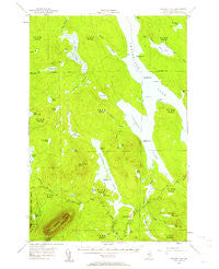
~ Ragged Lake ME topo map, 1:62500 scale, 15 X 15 Minute, Historical, 1954, updated 1961
Ragged Lake, Maine, USGS topographic map dated 1954.
Includes geographic coordinates (latitude and longitude). This topographic map is suitable for hiking, camping, and exploring, or framing it as a wall map.
Printed on-demand using high resolution imagery, on heavy weight and acid free paper, or alternatively on a variety of synthetic materials.
Topos available on paper, Waterproof, Poly, or Tyvek. Usually shipping rolled, unless combined with other folded maps in one order.
- Product Number: USGS-5684991
- Free digital map download (high-resolution, GeoPDF): Ragged Lake, Maine (file size: 7 MB)
- Map Size: please refer to the dimensions of the GeoPDF map above
- Weight (paper map): ca. 55 grams
- Map Type: POD USGS Topographic Map
- Map Series: HTMC
- Map Verison: Historical
- Cell ID: 61418
- Scan ID: 460789
- Imprint Year: 1961
- Woodland Tint: Yes
- Aerial Photo Year: 1954
- Field Check Year: 1954
- Datum: NAD27
- Map Projection: Polyconic
- Map published by United States Geological Survey
- Map Language: English
- Scanner Resolution: 600 dpi
- Map Cell Name: Ragged Lake
- Grid size: 15 X 15 Minute
- Date on map: 1954
- Map Scale: 1:62500
- Geographical region: Maine, United States
Neighboring Maps:
All neighboring USGS topo maps are available for sale online at a variety of scales.
Spatial coverage:
Topo map Ragged Lake, Maine, covers the geographical area associated the following places:
- Bear Pond Brook - Bear Pond - Berry Pond - Bear Brook - T3 R12 WELS - Big Fisher Pond - Holmes Hole - Blood Pond - Big Spencer Mountain Trail - Grassy Pond - Ragged Stream - Black Brook - Little Fisher Pond - Grass Pond - Big Pine Pond - Cow Pond - Fourmile Brook - Quaker Brook - Ragged Lake Campsite - Sandy Point - Ragged Lake Dam - Ripogenus Pond - Cow Brook - Little Berry Pond - Pine Stream Flowage - TX R14 WELS - Weymouth Point - Black Cap Mountain - Round Pond - Mud Pond - Grant Farm - Salmon Pond - T2 R13 WELS - T2 R12 WELS - Little Pond - Shack Pond - Caribou Point - Deer Pond - Mud Brook - Otter Brook - Big Spencer Mountain - Red Brook - Caribou Brook - Caribou Lake - T4 R12 WELS - Piscataquis County - T3 R13 WELS - Cranberry Pond - Fisher Brook - T4 R13 WELS - Chesuncook Lake - Kidney Pond - Otter Pond - Mauser Island Campsite - Bear Brook Campsite - Cardesa Point Campsite - Ragged Lake
- Map Area ID: AREA4645.75-69.5-69.25
- Northwest corner Lat/Long code: USGSNW46-69.5
- Northeast corner Lat/Long code: USGSNE46-69.25
- Southwest corner Lat/Long code: USGSSW45.75-69.5
- Southeast corner Lat/Long code: USGSSE45.75-69.25
- Northern map edge Latitude: 46
- Southern map edge Latitude: 45.75
- Western map edge Longitude: -69.5
- Eastern map edge Longitude: -69.25


