
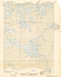
~ Morgan Harbor LA topo map, 1:31680 scale, 7.5 X 7.5 Minute, Historical, 1935
Morgan Harbor, Louisiana, USGS topographic map dated 1935.
Includes geographic coordinates (latitude and longitude). This topographic map is suitable for hiking, camping, and exploring, or framing it as a wall map.
Printed on-demand using high resolution imagery, on heavy weight and acid free paper, or alternatively on a variety of synthetic materials.
Topos available on paper, Waterproof, Poly, or Tyvek. Usually shipping rolled, unless combined with other folded maps in one order.
- Product Number: USGS-5683481
- Free digital map download (high-resolution, GeoPDF): Morgan Harbor, Louisiana (file size: 5 MB)
- Map Size: please refer to the dimensions of the GeoPDF map above
- Weight (paper map): ca. 55 grams
- Map Type: POD USGS Topographic Map
- Map Series: HTMC
- Map Verison: Historical
- Cell ID: 30215
- Scan ID: 333969
- Field Check Year: 1935
- Datum: NAD27
- Map Projection: Polyconic
- Advance: Yes
- Planimetric: Yes
- Map published by United States Geological Survey
- Keywords: Overedge with No Adjacent Map
- Map Language: English
- Scanner Resolution: 600 dpi
- Map Cell Name: Morgan Harbor
- Grid size: 7.5 X 7.5 Minute
- Date on map: 1935
- Map Scale: 1:31680
- Geographical region: Louisiana, United States
Neighboring Maps:
All neighboring USGS topo maps are available for sale online at a variety of scales.
Spatial coverage:
Topo map Morgan Harbor, Louisiana, covers the geographical area associated the following places:
- Christmas Camp Lake - Rawhead Island (historical) - Eloi Bay - Old Harry Bayou - Chicot Pass - Treasure Island Gas Field - Scow Pass - Point Eliza - Chandeleur Sound Block 25 Oil Field - Martinbox Bayou - Morgan Harbor Pass - Bayou Julia - Jules Cutoff - Skiff Lake - Twilight Harbor - Point Cahill - Morgan Harbor - Otter Bayou - Codfish Point - Point Lydia (historical) - Treasure Bay Pass - Dry Bread Island - Point Paulina (historical) - White Log Lake - Skiff Island
- Map Area ID: AREA29.87529.75-89.375-89.25
- Northwest corner Lat/Long code: USGSNW29.875-89.375
- Northeast corner Lat/Long code: USGSNE29.875-89.25
- Southwest corner Lat/Long code: USGSSW29.75-89.375
- Southeast corner Lat/Long code: USGSSE29.75-89.25
- Northern map edge Latitude: 29.875
- Southern map edge Latitude: 29.75
- Western map edge Longitude: -89.375
- Eastern map edge Longitude: -89.25


