
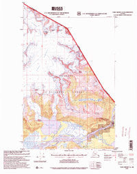
~ Taku River C 6 AK topo map, 1:63360 scale, 15 X 15 Minute, Historical, 1995, updated 1999
Taku River C 6, Alaska, USGS topographic map dated 1995.
Includes geographic coordinates (latitude and longitude). This topographic map is suitable for hiking, camping, and exploring, or framing it as a wall map.
Printed on-demand using high resolution imagery, on heavy weight and acid free paper, or alternatively on a variety of synthetic materials.
Topos available on paper, Waterproof, Poly, or Tyvek. Usually shipping rolled, unless combined with other folded maps in one order.
- Product Number: USGS-5682527
- Free digital map download (high-resolution, GeoPDF): Taku River C 6, Alaska (file size: 12 MB)
- Map Size: please refer to the dimensions of the GeoPDF map above
- Weight (paper map): ca. 55 grams
- Map Type: POD USGS Topographic Map
- Map Series: HTMC
- Map Verison: Historical
- Cell ID: 72966
- Scan ID: 359505
- Imprint Year: 1999
- Woodland Tint: Yes
- Aerial Photo Year: 1987
- Edit Year: 1995
- Datum: NAD27
- Map Projection: Transverse Mercator
- Map published by United States Geological Survey
- Map published by United States Forest Service
- Keywords: Overedge with No Adjacent Map
- Map Language: English
- Scanner Resolution: 600 dpi
- Map Cell Name: Taku River C-6
- Grid size: 15 X 15 Minute
- Date on map: 1995
- Map Scale: 1:63360
- Geographical region: Alaska, United States
Neighboring Maps:
All neighboring USGS topo maps are available for sale online at a variety of scales.
Spatial coverage:
Topo map Taku River C 6, Alaska, covers the geographical area associated the following places:
- Frostbite Peak - Fish Creek - East Twin Glacier - Michaels Sword - Bacon Glacier - The Horn Peaks - Sittakanay River - Canyon Island - Unknown Glacier - Yehring Creek - Moose Creek - Ivy Ridge - Antler Peaks - Devils Paw - Twin Glacier Peak - Twin Glacier Lake - Wright River - Couloir Peak - Boundary Lake - Camp 4 Peak - Campion Ditch - Johnson Creek - Hades Highway - Kluchman Mountain - West Twin Glacier
- Map Area ID: AREA58.7558.5-134-133.6666667
- Northwest corner Lat/Long code: USGSNW58.75-134
- Northeast corner Lat/Long code: USGSNE58.75-133.6666667
- Southwest corner Lat/Long code: USGSSW58.5-134
- Southeast corner Lat/Long code: USGSSE58.5-133.6666667
- Northern map edge Latitude: 58.75
- Southern map edge Latitude: 58.5
- Western map edge Longitude: -134
- Eastern map edge Longitude: -133.6666667


