
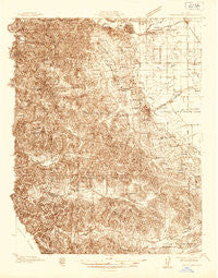
~ Sebastopol CA topo map, 1:48000 scale, 15 X 15 Minute, Historical, 1935
Sebastopol, California, USGS topographic map dated 1935.
Includes geographic coordinates (latitude and longitude). This topographic map is suitable for hiking, camping, and exploring, or framing it as a wall map.
Printed on-demand using high resolution imagery, on heavy weight and acid free paper, or alternatively on a variety of synthetic materials.
Topos available on paper, Waterproof, Poly, or Tyvek. Usually shipping rolled, unless combined with other folded maps in one order.
- Product Number: USGS-5678428
- Free digital map download (high-resolution, GeoPDF): Sebastopol, California (file size: 16 MB)
- Map Size: please refer to the dimensions of the GeoPDF map above
- Weight (paper map): ca. 55 grams
- Map Type: POD USGS Topographic Map
- Map Series: HTMC
- Map Verison: Historical
- Cell ID: 62240
- Scan ID: 301575
- Survey Year: 1935
- Datum: NAD27
- Map Projection: Polyconic
- Advance: Yes
- Map published by United States Geological Survey
- Keywords: Overedge; Nonstandard Press Run
- Map Language: English
- Scanner Resolution: 600 dpi
- Map Cell Name: Sebastopol
- Grid size: 15 X 15 Minute
- Date on map: 1935
- Map Scale: 1:48000
- Geographical region: California, United States
Neighboring Maps:
All neighboring USGS topo maps are available for sale online at a variety of scales.
Spatial coverage:
Topo map Sebastopol, California, covers the geographical area associated the following places:
- Lacresta (historical) - Fulton - Alliance Redwood - Valley Ford - Bloomfield - Molino - Turner - Fallon - Northwood Heights - Mills - Forestville - Orchard - Hessel - Ross - Hopyard (historical) - McCauley (historical) - Rio Dell - Trenton - Camp Meeker - Cunningham - Sebastopol - Knowles Corner - Llano - Harbine (historical) - Williams (historical) - Northwood Lodge - Freestone - Cadwell - Graton - Monroe - Woodworth - Sousa Corners - Two Rock - Occidental - Woolsey - Barlow - Mirabel Park - Manzana - Alten - Bodega - Noel Heights - Gravenstein - Riccas Corner - Summerhome Park - Dillon Beach - Santa Nella - Roblar - Fredericks - Hurlbut - Mirabel Heights
- Map Area ID: AREA38.538.25-123-122.75
- Northwest corner Lat/Long code: USGSNW38.5-123
- Northeast corner Lat/Long code: USGSNE38.5-122.75
- Southwest corner Lat/Long code: USGSSW38.25-123
- Southeast corner Lat/Long code: USGSSE38.25-122.75
- Northern map edge Latitude: 38.5
- Southern map edge Latitude: 38.25
- Western map edge Longitude: -123
- Eastern map edge Longitude: -122.75


