
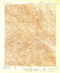
~ Branch Mtn CA topo map, 1:48000 scale, 15 X 15 Minute, Historical, 1937
Branch Mtn, California, USGS topographic map dated 1937.
Includes geographic coordinates (latitude and longitude). This topographic map is suitable for hiking, camping, and exploring, or framing it as a wall map.
Printed on-demand using high resolution imagery, on heavy weight and acid free paper, or alternatively on a variety of synthetic materials.
Topos available on paper, Waterproof, Poly, or Tyvek. Usually shipping rolled, unless combined with other folded maps in one order.
- Product Number: USGS-5678414
- Free digital map download (high-resolution, GeoPDF): Branch Mtn, California (file size: 20 MB)
- Map Size: please refer to the dimensions of the GeoPDF map above
- Weight (paper map): ca. 55 grams
- Map Type: POD USGS Topographic Map
- Map Series: HTMC
- Map Verison: Historical
- Cell ID: 51733
- Scan ID: 296619
- Survey Year: 1937
- Datum: NAD
- Map Projection: Polyconic
- Advance: Yes
- Map published by United States Geological Survey
- Keywords: Overedge; Nonstandard Press Run
- Map Language: English
- Scanner Resolution: 600 dpi
- Map Cell Name: Branch Mountain
- Grid size: 15 X 15 Minute
- Date on map: 1937
- Map Scale: 1:48000
- Geographical region: California, United States
Neighboring Maps:
All neighboring USGS topo maps are available for sale online at a variety of scales.
Spatial coverage:
Topo map Branch Mtn, California, covers the geographical area associated the following places:
- Machesna Spring - Branch Creek - Joughin Ranch - Gifford Ranch - Permasse Ranch - Pine Canyon Station - Double Springs - Pine Canyon - Lake Ridge Trail - Bluff Spring - Pine Flat - Gifford Spring - Garcin - Logan Creek - Soto Spring - Barrett Creek - Buckhorn Canyon - Buck Spring - Sycamore Ridge - Los Pelados - Charlie Valley - Buck Cove Spring - Miranda Pine Mountain - Glines Ranch - Shaw Canyon - Treplett Mountain - Little Jollo Creek - Chimney Canyon - Jack Spring - Plowshare Peak - Buckhorn Ranch - Aliso Creek - Aliso Canyon - Wilcox Canyon - Peartree Spring - Twin Rocks Trail - Brown Canyon - Davis Cabin - Porter Peak - Plowshare Spring - Yeary Ranch - Gypsum Canyon - Agua Escondido Campground - Logan Ridge - Sycamore Creek - Miranda Pine Spring - Los Machos Hills - Twin Rocks - Long Ridge - Gillam Spring - Paradise Campground - Pilitas Mountain - Sheep Creek - Quail Spring - Wild Hog Creek - Sheep Camp Creek - East Fork Brown Canyon - Avenales Observation - Big Rocks - Rice Ranch - Corral Creek - Dutchman Spring - Johnson Surprise Spring - Sulphur Spring - Carrisa Ranch - Timber Peak - Hunt Spring - Thirtyfive Canyon - Kennel Creek - Scott Ranch (historical) - Brown Mountain - Willow Spring - Willow Spring Trail - Miranda Pine Campground - Clear Creek - Agua Escondida Spring - Tajea Flat - Taylor Well - Glines Canyon - Luelling Ranch - Shell Peak - Garica Potrero Spring - Horseshoe Canyon - Indians Trail - Avenales Ranch - Live Oak Spring - Kerry Canyon Trail - Rock Front Ranch - Cuyama Valley - Branch Mountain - Porter Spring - Fish Creek - Thompson Spring - Cable Corral Spring - Iron Spring - Sierra Madre Picnic Area - Morris Ranch - Los Machos Creek - Plowshare Spring - Machesna Trail
- Map Area ID: AREA35.2535-120.25-120
- Northwest corner Lat/Long code: USGSNW35.25-120.25
- Northeast corner Lat/Long code: USGSNE35.25-120
- Southwest corner Lat/Long code: USGSSW35-120.25
- Southeast corner Lat/Long code: USGSSE35-120
- Northern map edge Latitude: 35.25
- Southern map edge Latitude: 35
- Western map edge Longitude: -120.25
- Eastern map edge Longitude: -120


