
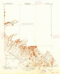
~ Clear Creek CA topo map, 1:31680 scale, 7.5 X 7.5 Minute, Historical, 1912, updated 1947
Clear Creek, California, USGS topographic map dated 1912.
Includes geographic coordinates (latitude and longitude). This topographic map is suitable for hiking, camping, and exploring, or framing it as a wall map.
Printed on-demand using high resolution imagery, on heavy weight and acid free paper, or alternatively on a variety of synthetic materials.
Topos available on paper, Waterproof, Poly, or Tyvek. Usually shipping rolled, unless combined with other folded maps in one order.
- Product Number: USGS-5677932
- Free digital map download (high-resolution, GeoPDF): Clear Creek, California (file size: 5 MB)
- Map Size: please refer to the dimensions of the GeoPDF map above
- Weight (paper map): ca. 55 grams
- Map Type: POD USGS Topographic Map
- Map Series: HTMC
- Map Verison: Historical
- Cell ID: 19102
- Scan ID: 296002
- Imprint Year: 1947
- Survey Year: 1910
- Datum: Unstated
- Map Projection: Polyconic
- Map published by United States Geological Survey
- Keywords: Overedge
- Map Language: English
- Scanner Resolution: 600 dpi
- Map Cell Name: Hamlin Canyon
- Grid size: 7.5 X 7.5 Minute
- Date on map: 1912
- Map Scale: 1:31680
- Geographical region: California, United States
Neighboring Maps:
All neighboring USGS topo maps are available for sale online at a variety of scales.
Spatial coverage:
Topo map Clear Creek, California, covers the geographical area associated the following places:
- Beauty Peak - Perkins Ridge - Honey Run - Clarenback Point - McKay Ridge - Butte County Fire Department Station 26 - Clear Creek School - Butte Creek Canyon Census Designated Place - Flatiron - Steamboat Rock - White Spring - Berry Canyon - West Branch Clear Creek - Little Butte Creek - Butte Valley Census Designated Place - The Narrows - Nance Canyon - KKXX-AM (Mulberry) - Butte County Fire Department Station 25 - Cory Canyon - Elliot Spring House - KHSL-AM (Chico) - Butte College - Coon Ridge - KKXX-AM (Paradise) - Shirttail Canyon - Hayes Canyon - Robbers Roost - Castle Rock - Carson Spring - Deadman Spring - Nugen Canyon - KHAP-FM (Chico) - Hamlin Canyon
- Map Area ID: AREA39.7539.625-121.75-121.625
- Northwest corner Lat/Long code: USGSNW39.75-121.75
- Northeast corner Lat/Long code: USGSNE39.75-121.625
- Southwest corner Lat/Long code: USGSSW39.625-121.75
- Southeast corner Lat/Long code: USGSSE39.625-121.625
- Northern map edge Latitude: 39.75
- Southern map edge Latitude: 39.625
- Western map edge Longitude: -121.75
- Eastern map edge Longitude: -121.625


