
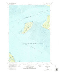
~ Tyonek A 1 AK topo map, 1:63360 scale, 15 X 15 Minute, Historical, 1951, updated 1974
Tyonek A 1, Alaska, USGS topographic map dated 1951.
Includes geographic coordinates (latitude and longitude). This topographic map is suitable for hiking, camping, and exploring, or framing it as a wall map.
Printed on-demand using high resolution imagery, on heavy weight and acid free paper, or alternatively on a variety of synthetic materials.
Topos available on paper, Waterproof, Poly, or Tyvek. Usually shipping rolled, unless combined with other folded maps in one order.
- Product Number: USGS-5674532
- Free digital map download (high-resolution, GeoPDF): Tyonek A 1, Alaska (file size: 13 MB)
- Map Size: please refer to the dimensions of the GeoPDF map above
- Weight (paper map): ca. 55 grams
- Map Type: POD USGS Topographic Map
- Map Series: HTMC
- Map Verison: Historical
- Cell ID: 63798
- Scan ID: 359988
- Imprint Year: 1974
- Woodland Tint: Yes
- Aerial Photo Year: 1950
- Edit Year: 1970
- Datum: NAD27
- Map Projection: Universal Transverse Mercator
- Map published by United States Geological Survey
- Map Language: English
- Scanner Resolution: 600 dpi
- Map Cell Name: Tyonek A-1
- Grid size: 15 X 15 Minute
- Date on map: 1951
- Map Scale: 1:63360
- Geographical region: Alaska, United States
Neighboring Maps:
All neighboring USGS topo maps are available for sale online at a variety of scales.
Spatial coverage:
Topo map Tyonek A 1, Alaska, covers the geographical area associated the following places:
- Point Mackenzie Heliport - Diamond Lake - Point Campbell - West Point Shoal - Fire Island Shoal - Point Woronzof - Race Point Light - Point Campbell - Kincaid Park (historical) - Point Campbell-Kincaid Park - West Point - Point Campbell Military Reservation (historical) - Fire Island Air Force Station (historical) - Fire Island Moose Range - North Point Shoal - Race Point - Fire Island Airport - Knik Arm Shoal - Woronzof Shoal - Shelter Bay - Little Campbell Lake - Fire Island Light - Fire Island - Point Possession - North Point
- Map Area ID: AREA61.2561-150.375-150
- Northwest corner Lat/Long code: USGSNW61.25-150.375
- Northeast corner Lat/Long code: USGSNE61.25-150
- Southwest corner Lat/Long code: USGSSW61-150.375
- Southeast corner Lat/Long code: USGSSE61-150
- Northern map edge Latitude: 61.25
- Southern map edge Latitude: 61
- Western map edge Longitude: -150.375
- Eastern map edge Longitude: -150


