
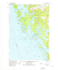
~ Sitka C 7 AK topo map, 1:63360 scale, 15 X 15 Minute, Historical, 1951, updated 1976
Sitka C 7, Alaska, USGS topographic map dated 1951.
Includes geographic coordinates (latitude and longitude). This topographic map is suitable for hiking, camping, and exploring, or framing it as a wall map.
Printed on-demand using high resolution imagery, on heavy weight and acid free paper, or alternatively on a variety of synthetic materials.
Topos available on paper, Waterproof, Poly, or Tyvek. Usually shipping rolled, unless combined with other folded maps in one order.
- Product Number: USGS-5672966
- Free digital map download (high-resolution, GeoPDF): Sitka C 7, Alaska (file size: 12 MB)
- Map Size: please refer to the dimensions of the GeoPDF map above
- Weight (paper map): ca. 55 grams
- Map Type: POD USGS Topographic Map
- Map Series: HTMC
- Map Verison: Historical
- Cell ID: 73138
- Scan ID: 359148
- Imprint Year: 1976
- Woodland Tint: Yes
- Aerial Photo Year: 1948
- Edit Year: 1975
- Datum: NAD27
- Map Projection: Universal Transverse Mercator
- Map published by United States Geological Survey
- Map Language: English
- Scanner Resolution: 600 dpi
- Map Cell Name: Sitka C-7
- Grid size: 15 X 15 Minute
- Date on map: 1951
- Map Scale: 1:63360
- Geographical region: Alaska, United States
Neighboring Maps:
All neighboring USGS topo maps are available for sale online at a variety of scales.
Spatial coverage:
Topo map Sitka C 7, Alaska, covers the geographical area associated the following places:
- Klag Bay - Didrickson Bay - Ninefoot Shoal - Kukkan Passage - Whitestripe Mountain - Trap Point - Snipe ock - Khaz Point - Guide Rock - Imperial Passage - Sister Lake - Whitestripe Lake - Division Point - Marble Creek - Oval Rock - Minnie Reef - Hirst-Chichagof Mine (historical) - Ramp Island - Rough Channel - Twin Island - Quit Point - Chichagof - Mount Lydonia - Clearing Point - The Gate - Dippy Island - Khaz Head - Takeena Peninsula - Hogan Island - Deuce Island - Port Island - Sholin Island - Three Tree Island - Drip Point - Rose Point - Khaz Breakers - Black Bay - Black Lake - Black River - Hirst Mountain - Lydonia Island - Granite Islands - Double Cove - Cape Edward - Frog Rock - Gray Rock - Fitz Island - Myriad Islands - Black Island - Shale Island - Smooth Channel - Fox Point - White Sisters - Khaz Bay - Leo Island - Goon Dip River - Elbow Passage - Surveyor Passage - Slope Point - Kimshan Cove - Flat Top Mountain - Tawak Passage - Lock Island - Ogden Passage - Snipe Rock - Portlock Harbor - Paulina Island - Edward Islands - Elkugu Bay - Hogan Point - Kimshan Cove - Middle Breaker - Chichagof Creek - Ittar Rock - Gig Pass - Klag Island - Copper Point - Williams Hill - Baird Island - Freeburn Mountain - Point Hope - Black Rock - Vorota Island - Triplet Islands - Steep Island - Lake Anna - Kukkan Bay - Fran Reef - Maud Point - Point Lydonia - Vein Point - Snipe Island - South Passage - Herbert Graves Island - West Chichagof-Yakobi Wilderness - Elkugu Island - Piehle Passage - Doolth Mountain - Duck Island - Rowe Island
- Map Area ID: AREA57.7557.5-136.3333333-136
- Northwest corner Lat/Long code: USGSNW57.75-136.3333333
- Northeast corner Lat/Long code: USGSNE57.75-136
- Southwest corner Lat/Long code: USGSSW57.5-136.3333333
- Southeast corner Lat/Long code: USGSSE57.5-136
- Northern map edge Latitude: 57.75
- Southern map edge Latitude: 57.5
- Western map edge Longitude: -136.3333333
- Eastern map edge Longitude: -136


