
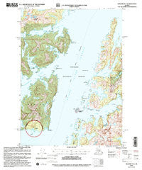
~ Seward B 3 AK topo map, 1:63360 scale, 15 X 15 Minute, Historical, 2000, updated 2002
Seward B 3, Alaska, USGS topographic map dated 2000.
Includes geographic coordinates (latitude and longitude). This topographic map is suitable for hiking, camping, and exploring, or framing it as a wall map.
Printed on-demand using high resolution imagery, on heavy weight and acid free paper, or alternatively on a variety of synthetic materials.
Topos available on paper, Waterproof, Poly, or Tyvek. Usually shipping rolled, unless combined with other folded maps in one order.
- Product Number: USGS-5672498
- Free digital map download (high-resolution, GeoPDF): Seward B 3, Alaska (file size: 15 MB)
- Map Size: please refer to the dimensions of the GeoPDF map above
- Weight (paper map): ca. 55 grams
- Map Type: POD USGS Topographic Map
- Map Series: HTMC
- Map Verison: Historical
- Cell ID: 62370
- Scan ID: 358908
- Imprint Year: 2002
- Woodland Tint: Yes
- Aerial Photo Year: 1975
- Edit Year: 2000
- Datum: NAD27
- Map Projection: Transverse Mercator
- Map published by United States Geological Survey
- Map published by United States Forest Service
- Map Language: English
- Scanner Resolution: 600 dpi
- Map Cell Name: Seward B-3
- Grid size: 15 X 15 Minute
- Date on map: 2000
- Map Scale: 1:63360
- Geographical region: Alaska, United States
Neighboring Maps:
All neighboring USGS topo maps are available for sale online at a variety of scales.
Spatial coverage:
Topo map Seward B 3, Alaska, covers the geographical area associated the following places:
- Clump Point - Cathead Bay - Knight Island Passage - Range Island - Chenega Post Office (historical) - Channel Rock - Pass Island - Paddy Bay - Chenega Point - Eshamy Lake - Long Channel - Mummy Island - Drier Bay - Squirrel Island - Chase Island - Eshamy Creek - Junction Island - Paddy Point - Barnes Cove - Granite Bay - Mallard Head - Herring Point - Mountain Point - Cat Head - Kake Cove - Clam Islands - Port Audrey - Mallard Bay - Point Nowell - Eshamy Peak - Ewan Island - Rocky Island - Gunboat Lakes - Johnson Bay - Lower Herring Bay - Dangerous Passage - New Year Islands - Ewan Point - Eshamy Bay - Copper Bay - New Year Island - Masked Bay - Rubber Boot Lake - Chenega Cove - Rocky Point - Eshamy Lagoon - Chenega Island - Aguliak Island
- Map Area ID: AREA60.560.25-148.125-147.75
- Northwest corner Lat/Long code: USGSNW60.5-148.125
- Northeast corner Lat/Long code: USGSNE60.5-147.75
- Southwest corner Lat/Long code: USGSSW60.25-148.125
- Southeast corner Lat/Long code: USGSSE60.25-147.75
- Northern map edge Latitude: 60.5
- Southern map edge Latitude: 60.25
- Western map edge Longitude: -148.125
- Eastern map edge Longitude: -147.75


