
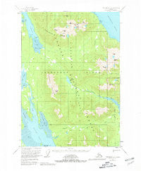
~ Petersburg D 4 AK topo map, 1:63360 scale, 15 X 15 Minute, Historical, 1951, updated 1981
Petersburg D 4, Alaska, USGS topographic map dated 1951.
Includes geographic coordinates (latitude and longitude). This topographic map is suitable for hiking, camping, and exploring, or framing it as a wall map.
Printed on-demand using high resolution imagery, on heavy weight and acid free paper, or alternatively on a variety of synthetic materials.
Topos available on paper, Waterproof, Poly, or Tyvek. Usually shipping rolled, unless combined with other folded maps in one order.
- Product Number: USGS-5671466
- Free digital map download (high-resolution, GeoPDF): Petersburg D 4, Alaska (file size: 10 MB)
- Map Size: please refer to the dimensions of the GeoPDF map above
- Weight (paper map): ca. 55 grams
- Map Type: POD USGS Topographic Map
- Map Series: HTMC
- Map Verison: Historical
- Cell ID: 60918
- Scan ID: 358377
- Imprint Year: 1981
- Woodland Tint: Yes
- Aerial Photo Year: 1948
- Edit Year: 1980
- Datum: NAD27
- Map Projection: Universal Transverse Mercator
- Map published by United States Geological Survey
- Map Language: English
- Scanner Resolution: 600 dpi
- Map Cell Name: Petersburg D-4
- Grid size: 15 X 15 Minute
- Date on map: 1951
- Map Scale: 1:63360
- Geographical region: Alaska, United States
Neighboring Maps:
All neighboring USGS topo maps are available for sale online at a variety of scales.
Spatial coverage:
Topo map Petersburg D 4, Alaska, covers the geographical area associated the following places:
- Twelvemile Creek - Hunt Peak - Del Monte Peak - Kane Peak - Harrington Rock - Petersburg Lake - Sherman Peak - Salt Chuck - Goose Point - Cape Strait - Ambler Peak - Taylor Creek - Goose Cove - Ohmer Slough - Duncan Canal Portage - Scott Peak - Coho Creek - Lockwood Peak - Dry Cove - Putnam Peak - Duncan Peaks - Duncan Creek - De Long Peak - Lindenberg Peninsula - Chipp Peak - Colp Lake - Hook Point - McDonald Arm - Petersburg Trail - Sheridan Peak - Hall Peak - Stop Island - North Arm Duncan Canal - Missionary Range - Petersburg Creek-Duncan Salt Chuck Wilderness - Portage Mountain - Flat Point - Portage Bay
- Map Area ID: AREA5756.75-133.3333333-133
- Northwest corner Lat/Long code: USGSNW57-133.3333333
- Northeast corner Lat/Long code: USGSNE57-133
- Southwest corner Lat/Long code: USGSSW56.75-133.3333333
- Southeast corner Lat/Long code: USGSSE56.75-133
- Northern map edge Latitude: 57
- Southern map edge Latitude: 56.75
- Western map edge Longitude: -133.3333333
- Eastern map edge Longitude: -133


