
~ False Pass B 2 AK topo map, 1:63360 scale, 15 X 15 Minute, Historical, 1989, updated 1989
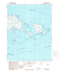
False Pass B 2, Alaska, USGS topographic map dated 1989.
Includes geographic coordinates (latitude and longitude). This topographic map is suitable for hiking, camping, and exploring, or framing it as a wall map.
Printed on-demand using high resolution imagery, on heavy weight and acid free paper, or alternatively on a variety of synthetic materials.
Topos available on paper, Waterproof, Poly, or Tyvek. Usually shipping rolled, unless combined with other folded maps in one order.
- Product Number: USGS-5666050
- Free digital map download (high-resolution, GeoPDF): False Pass B 2, Alaska (file size: 13 MB)
- Map Size: please refer to the dimensions of the GeoPDF map above
- Weight (paper map): ca. 55 grams
- Map Type: POD USGS Topographic Map
- Map Series: HTMC
- Map Verison: Historical
- Cell ID: 54072
- Scan ID: 355640
- Imprint Year: 1989
- Aerial Photo Year: 1974
- Edit Year: 1989
- Datum: NAD27
- Map Projection: Universal Transverse Mercator
- Provisional map: Yes
- Map published by United States Geological Survey
- Map Language: English
- Scanner Resolution: 600 dpi
- Map Cell Name: False Pass B-2
- Grid size: 15 X 15 Minute
- Date on map: 1989
- Map Scale: 1:63360
- Geographical region: Alaska, United States
Neighboring Maps:
All neighboring USGS topo maps are available for sale online at a variety of scales.
Spatial coverage:
Topo map False Pass B 2, Alaska, covers the geographical area associated the following places:
- Northeast Point - Lookout Point - Southeast Pass - Telemitz Island - Peterson Island - Northeast Harbor - Lida Anchorage - Salmon Bay - Finneys Island - Wanda Island - Enton Point - Seal Rock - Unimak Cove - Inikla Island - Caton Harbor - Peterson Bay - Lida Island - Princess Rock - Johnson Bay - Umla Island - Whale Bay - Elma Island - Sanak Islands - Caton Island - Mary Island - Whale Point - Finneys Bay - Gunboat Island - Eagle Rock - Dora Island - Fairway Reef
- Map Area ID: AREA54.554.25-162.6666667-162.3333333
- Northwest corner Lat/Long code: USGSNW54.5-162.6666667
- Northeast corner Lat/Long code: USGSNE54.5-162.3333333
- Southwest corner Lat/Long code: USGSSW54.25-162.6666667
- Southeast corner Lat/Long code: USGSSE54.25-162.3333333
- Northern map edge Latitude: 54.5
- Southern map edge Latitude: 54.25
- Western map edge Longitude: -162.6666667
- Eastern map edge Longitude: -162.3333333


