
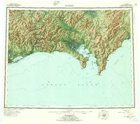
~ Solomon AK topo map, 1:250000 scale, 1 X 3 Degree, Historical, 1950, updated 1956
Solomon, Alaska, USGS topographic map dated 1950.
Includes geographic coordinates (latitude and longitude). This topographic map is suitable for hiking, camping, and exploring, or framing it as a wall map.
Printed on-demand using high resolution imagery, on heavy weight and acid free paper, or alternatively on a variety of synthetic materials.
Topos available on paper, Waterproof, Poly, or Tyvek. Usually shipping rolled, unless combined with other folded maps in one order.
- Product Number: USGS-5662028
- Free digital map download (high-resolution, GeoPDF): Solomon, Alaska (file size: 29 MB)
- Map Size: please refer to the dimensions of the GeoPDF map above
- Weight (paper map): ca. 55 grams
- Map Type: POD USGS Topographic Map
- Map Series: HTMC
- Map Verison: Historical
- Cell ID: 75061
- Scan ID: 361844
- Imprint Year: 1956
- Visual Version Number: 1
- Aerial Photo Year: 1950
- Datum: NAD27
- Map Projection: Universal Transverse Mercator
- Shaded Relief map: Yes
- Map published by United States Geological Survey
- Map Language: English
- Scanner Resolution: 600 dpi
- Map Cell Name: Solomon
- Grid size: 1 X 3 Degree
- Date on map: 1950
- Map Scale: 1:250000
- Geographical region: Alaska, United States
Neighboring Maps:
All neighboring USGS topo maps are available for sale online at a variety of scales.
Spatial coverage:
Topo map Solomon, Alaska, covers the geographical area associated the following places:
- Cape Nome - Bluff - Solomon - Imokhtegokshuk (historical) - White Mountain - East Fork - Quigleys Camp - Moses Point - Iron Creek - Topkok (historical) - Akpaliut (historical) - Ukodlint (historical) - Port Safety - Iknetuk (historical) - Elim - Moses Point Fishing Village - Golovin - Council - Walla Walla - Casadepaga - Lees Camp
- Map Area ID: AREA6564-165-162
- Northwest corner Lat/Long code: USGSNW65-165
- Northeast corner Lat/Long code: USGSNE65-162
- Southwest corner Lat/Long code: USGSSW64-165
- Southeast corner Lat/Long code: USGSSE64-162
- Northern map edge Latitude: 65
- Southern map edge Latitude: 64
- Western map edge Longitude: -165
- Eastern map edge Longitude: -162


