
~ Seguam AK topo map, 1:250000 scale, 1 X 2 Degree, Historical, 1951, updated 1952
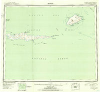
Seguam, Alaska, USGS topographic map dated 1951.
Includes geographic coordinates (latitude and longitude). This topographic map is suitable for hiking, camping, and exploring, or framing it as a wall map.
Printed on-demand using high resolution imagery, on heavy weight and acid free paper, or alternatively on a variety of synthetic materials.
Topos available on paper, Waterproof, Poly, or Tyvek. Usually shipping rolled, unless combined with other folded maps in one order.
- Product Number: USGS-5661874
- Free digital map download (high-resolution, GeoPDF): Seguam, Alaska (file size: 8 MB)
- Map Size: please refer to the dimensions of the GeoPDF map above
- Weight (paper map): ca. 55 grams
- Map Type: POD USGS Topographic Map
- Map Series: HTMC
- Map Verison: Historical
- Cell ID: 69022
- Scan ID: 361394
- Imprint Year: 1952
- Datum: NAD27
- Map Projection: Universal Transverse Mercator
- Map published by United States Geological Survey
- Map Language: English
- Scanner Resolution: 600 dpi
- Map Cell Name: Seguam
- Grid size: 1 X 2 Degree
- Date on map: 1951
- Map Scale: 1:250000
- Geographical region: Alaska, United States
Neighboring Maps:
All neighboring USGS topo maps are available for sale online at a variety of scales.
Spatial coverage:
Topo map Seguam, Alaska, covers the geographical area associated the following places:
- Hiitxagiidax - Aagumchiidalix - Aleutian Islands - Naagix Qaxchxix - Agligadak Reefs - Tinas - Wharf Point - Atuung Aagayuuxtas - Qaluga - Seguam Pass - Camel Islet - Haanugim-tutucha - Aguulux - Agamsax - Kadax - Uhmaaga - Uchiing - Haanugix - Qigaagix Qaxchxix - Chuliidga - Kagalusux - Kalulam-tatuu - Hasxugiidax - Quchiix - Haanugiidax - Adaxsum Ixchxa - Chankusix - Cape Shaw - Chalugas Bay - Naagix Sangus - Klochkof Rock - Qalgizax - Finch Point - Kunalisxux - Amukta Pass - Lava Point - Asagam Udaa - Saddleridge Point - Chumliisim Tatuu - Cape Agligadak - Kalulam-tatugan Hachan Tanangis - Gudagis - Pyre Peak - Amlagim Qigaagix Angtaa - Qagangiiguudax - Kaalam-tutucha - Ukalam Ungluu - Ayagas Hidaluu - Sigungux - Hanitunax - Hanisxa - Kuuchaxsis - Tihniqidas - Usagiilux - Chukaalux - Aayangiilgis - Amaxsigix - Ululax - Finch Cove - Sagigik Island - Naagix Udiix - Chugumanax - Uzamkux - Sviechnikof Harbor - Saxtusix - Huxsiilux - Hadgiilux - Chaamlaga - Quxsus - Chaluugis Hidaluu - Kagalusum Hachan Tanangis - Tukum-sngaluga - Qasilasix - Sxulax - Tanagayugim Hidaluu - Chngadigax - Angyax - Suluga - Tinas Hasaa - Uyaxsax - Achiix - Kuchis - Sitaadaga - Umaatanax - Akuudgix - Uxaxsux - Cape Misty - Qusugiinax - Tinas Kadaa - Agugnadigax - Qagangiigux - Qugdugiidax - Chyaguulax - Tanadak Island - Rue Ledge - Tanagayux - Agdas - Hiitxagiidam-qagangan Udaa - Chalulax - Qumdaga
- Map Area ID: AREA52.551.5-174-172
- Northwest corner Lat/Long code: USGSNW52.5-174
- Northeast corner Lat/Long code: USGSNE52.5-172
- Southwest corner Lat/Long code: USGSSW51.5-174
- Southeast corner Lat/Long code: USGSSE51.5-172
- Northern map edge Latitude: 52.5
- Southern map edge Latitude: 51.5
- Western map edge Longitude: -174
- Eastern map edge Longitude: -172


