
~ Craig AK topo map, 1:250000 scale, 1 X 2 Degree, Historical, 1957, updated 1973
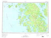
Craig, Alaska, USGS topographic map dated 1957.
Includes geographic coordinates (latitude and longitude). This topographic map is suitable for hiking, camping, and exploring, or framing it as a wall map.
Printed on-demand using high resolution imagery, on heavy weight and acid free paper, or alternatively on a variety of synthetic materials.
Topos available on paper, Waterproof, Poly, or Tyvek. Usually shipping rolled, unless combined with other folded maps in one order.
- Product Number: USGS-5660826
- Free digital map download (high-resolution, GeoPDF): Craig, Alaska (file size: 21 MB)
- Map Size: please refer to the dimensions of the GeoPDF map above
- Weight (paper map): ca. 55 grams
- Map Type: POD USGS Topographic Map
- Map Series: HTMC
- Map Verison: Historical
- Cell ID: 75044
- Scan ID: 361764
- Imprint Year: 1973
- Woodland Tint: Yes
- Edit Year: 1972
- Survey Year: 1956
- Datum: NAD27
- Map Projection: Universal Transverse Mercator
- Map published by United States Geological Survey
- Map Language: English
- Scanner Resolution: 600 dpi
- Map Cell Name: Craig
- Grid size: 1 X 2 Degree
- Date on map: 1957
- Map Scale: 1:250000
- Geographical region: Alaska, United States
Neighboring Maps:
All neighboring USGS topo maps are available for sale online at a variety of scales.
Spatial coverage:
Topo map Craig, Alaska, covers the geographical area associated the following places:
- Polk Inlet - Grindall (historical) - Hollis (historical) - Waterfall - Sulzer (historical) - Old Kasaan - Deweyville (historical) - Hadley (historical) - Edna Bay - Craig - New Tokeen - Klawock - Hydaburg - Tolstoi Bay (historical) - Salt Chuck - Thorne Bay - Dolomi (historical) - Hollis - Naukati Bay - Tuxekan (historical) - Chomly (historical) - Kasaan - Hetta (historical) - Port Alice - Meyers Chuck - Karheen (historical) - Niblack (historical) - Coppermount (historical) - Tokeen - Cape Pole - Copper City (historical) - Dora Bay
- Map Area ID: AREA5655-134.6666667-132
- Northwest corner Lat/Long code: USGSNW56-134.6666667
- Northeast corner Lat/Long code: USGSNE56-132
- Southwest corner Lat/Long code: USGSSW55-134.6666667
- Southeast corner Lat/Long code: USGSSE55-132
- Northern map edge Latitude: 56
- Southern map edge Latitude: 55
- Western map edge Longitude: -134.6666667
- Eastern map edge Longitude: -132


