
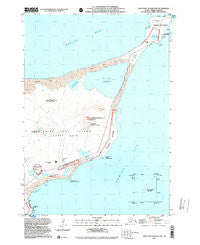
~ Saint Paul Island East AK topo map, 1:25000 scale, 7.5 X 7.5 Minute, Historical, 2001, updated 2002
Saint Paul Island East, Alaska, USGS topographic map dated 2001.
Includes geographic coordinates (latitude and longitude). This topographic map is suitable for hiking, camping, and exploring, or framing it as a wall map.
Printed on-demand using high resolution imagery, on heavy weight and acid free paper, or alternatively on a variety of synthetic materials.
Topos available on paper, Waterproof, Poly, or Tyvek. Usually shipping rolled, unless combined with other folded maps in one order.
- Product Number: USGS-5660238
- Free digital map download (high-resolution, GeoPDF): Saint Paul Island East, Alaska (file size: 11 MB)
- Map Size: please refer to the dimensions of the GeoPDF map above
- Weight (paper map): ca. 55 grams
- Map Type: POD USGS Topographic Map
- Map Series: HTMC
- Map Verison: Historical
- Cell ID: 395639
- Scan ID: 353772
- Imprint Year: 2002
- Aerial Photo Year: 2001
- Datum: NAD83
- Map Projection: Universal Transverse Mercator
- Map published by United States Geological Survey
- Map published by United States Department of Commerce
- Keywords: Inset; Overedge
- Map Language: English
- Scanner Resolution: 600 dpi
- Map Cell Name: Saint Paul Island East
- Grid size: 7.5 X 7.5 Minute
- Date on map: 2001
- Map Scale: 1:25000
- Geographical region: Alaska, United States
Neighboring Maps:
All neighboring USGS topo maps are available for sale online at a variety of scales.
Spatial coverage:
Topo map Saint Paul Island East, Alaska, covers the geographical area associated the following places:
- Chugux̂ Anii - Polovina Lake - Luugix̂ Anii - Rocky Lake - Kamenisti Lake - Icehouse Lake - Lake Dune - St Paul Island Airport - Sheep Lake - Lake Hill - Lukanin Point - Polovina Hill - Little Polovina Rookery - Webster Lake - Anidax Anii - Pribilof Islands - Lukanin Bay - Chugilgux̂ - Vostochnie - Stony Point - Hutchinson Hill - Chigilix Anii - Kalukax̂ Anii - Little Polovina Hill - Polovina Sands - Qyaam Aniidax̂ - Seal Island Historic District - Qakaankinga - Qayam Anii - Baraabrax̂ Anii - City of Saint Paul - Vesolia Mista - Bluudichax̂ Anii - Chuluugidax̂ Anii - Chaaskax̂ Anii - North Beach - Qamgaagam Anii - Cross Hill - Qaqa Anii - Lukanin Hill - Unalix̂talix Uluux̂tanax̂ Anii - Sakuchax̂ Anii - Tumdaanax Anii - Polovina Point - North Bay - Polovina Rookery - Loran Station Saint Paul - Ngatxux Uluux̂tanax̂ Anii - Kaxilax Anii - Big Lake
- Map Area ID: AREA57.2557.125-170.2666667-170.1
- Northwest corner Lat/Long code: USGSNW57.25-170.2666667
- Northeast corner Lat/Long code: USGSNE57.25-170.1
- Southwest corner Lat/Long code: USGSSW57.125-170.2666667
- Southeast corner Lat/Long code: USGSSE57.125-170.1
- Northern map edge Latitude: 57.25
- Southern map edge Latitude: 57.125
- Western map edge Longitude: -170.2666667
- Eastern map edge Longitude: -170.1


