
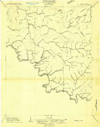
~ Matewan WV topo map, 1:48000 scale, 15 X 15 Minute, Historical, 1909
Matewan, West Virginia, USGS topographic map dated 1909.
Includes geographic coordinates (latitude and longitude). This topographic map is suitable for hiking, camping, and exploring, or framing it as a wall map.
Printed on-demand using high resolution imagery, on heavy weight and acid free paper, or alternatively on a variety of synthetic materials.
Topos available on paper, Waterproof, Poly, or Tyvek. Usually shipping rolled, unless combined with other folded maps in one order.
- Product Number: USGS-5660018
- Free digital map download (high-resolution, GeoPDF): Matewan, West Virginia (file size: 7 MB)
- Map Size: please refer to the dimensions of the GeoPDF map above
- Weight (paper map): ca. 55 grams
- Map Type: POD USGS Topographic Map
- Map Series: HTMC
- Map Verison: Historical
- Cell ID: 57265
- Scan ID: 253257
- Survey Year: 1909
- Datum: Unstated
- Map Projection: Unstated
- Advance: Yes
- Planimetric: Yes
- Map published by United States Geological Survey
- Keywords: Overedge; Nonstandard Press Run
- Map Language: English
- Scanner Resolution: 600 dpi
- Map Cell Name: Matewan
- Grid size: 15 X 15 Minute
- Date on map: 1909
- Map Scale: 1:48000
- Geographical region: West Virginia, United States
Neighboring Maps:
All neighboring USGS topo maps are available for sale online at a variety of scales.
Spatial coverage:
Topo map Matewan, West Virginia, covers the geographical area associated the following places:
- Lindsey - Arrow (historical) - Blackberry City - Hardy - Stopover - Matewan - Freeburn - Cedar - New Thacker (historical) - Hinch - Woodman - Sprigg - Lando Mines - Musick - Bias - Delbarton - Phelps - Buskirk - Aflex - New Alma Coal Camp (historical) - Majestic - Sydnor Addition - Calico - Thacker Mines - Ragland - Stirrat - Devon - North Matewan - Columbiatown (historical) - Surosa - Meador - Stringtown - Delorme - Burch - Red Jacket - Meathouse (historical) - Cinderella - Narrows Branch (historical) - Nampa (historical) - Thacker - Puritan Mines - Varney - Merrimac - Newtown - Ransom - Burnwell - Left Fork of Blackberry (historical) - Pie - McCarr - Board Tree - Lynn - Vulcan - Barnabus - Taylorville - Rawl - Oilville - Lobata
- Map Area ID: AREA37.7537.5-82.25-82
- Northwest corner Lat/Long code: USGSNW37.75-82.25
- Northeast corner Lat/Long code: USGSNE37.75-82
- Southwest corner Lat/Long code: USGSSW37.5-82.25
- Southeast corner Lat/Long code: USGSSE37.5-82
- Northern map edge Latitude: 37.75
- Southern map edge Latitude: 37.5
- Western map edge Longitude: -82.25
- Eastern map edge Longitude: -82


