
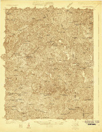
~ Critz VA topo map, 1:48000 scale, 15 X 15 Minute, Historical, 1926
Critz, Virginia, USGS topographic map dated 1926.
Includes geographic coordinates (latitude and longitude). This topographic map is suitable for hiking, camping, and exploring, or framing it as a wall map.
Printed on-demand using high resolution imagery, on heavy weight and acid free paper, or alternatively on a variety of synthetic materials.
Topos available on paper, Waterproof, Poly, or Tyvek. Usually shipping rolled, unless combined with other folded maps in one order.
- Product Number: USGS-5659746
- Free digital map download (high-resolution, GeoPDF): Critz, Virginia (file size: 18 MB)
- Map Size: please refer to the dimensions of the GeoPDF map above
- Weight (paper map): ca. 55 grams
- Map Type: POD USGS Topographic Map
- Map Series: HTMC
- Map Verison: Historical
- Cell ID: 53089
- Scan ID: 187684
- Survey Year: 1926
- Datum: NAD
- Map Projection: Polyconic
- Advance: Yes
- Map published by United States Geological Survey
- Keywords: Nonstandard Press Run; Overedge
- Map Language: English
- Scanner Resolution: 600 dpi
- Map Cell Name: Critz
- Grid size: 15 X 15 Minute
- Date on map: 1926
- Map Scale: 1:48000
- Geographical region: Virginia, United States
Neighboring Maps:
All neighboring USGS topo maps are available for sale online at a variety of scales.
Spatial coverage:
Topo map Critz, Virginia, covers the geographical area associated the following places:
- Lackey Store (historical) - Sheppards Mill - Gilbert Mill - Stones Store - Coleville (historical) - Blackberry - Critz - Dillons Fork - Campbell (historical) - Craig - Oak Ridge - Spencer - Stella - Old Well Crossing - Fryes Store (historical) - Moorefield Store - Reynolds Mill - Nettle Ridge - Goinstown (historical) - Pannill Fork - Koger (historical) - Sanville - Patrick Springs - Buffalo Ridge - Amostown - Palmetto (historical) - Shelton Store (historical) - Pleasant Grove - Bowling Springs (historical) - Atwood (historical)
- Map Area ID: AREA36.7536.5-80.25-80
- Northwest corner Lat/Long code: USGSNW36.75-80.25
- Northeast corner Lat/Long code: USGSNE36.75-80
- Southwest corner Lat/Long code: USGSSW36.5-80.25
- Southeast corner Lat/Long code: USGSSE36.5-80
- Northern map edge Latitude: 36.75
- Southern map edge Latitude: 36.5
- Western map edge Longitude: -80.25
- Eastern map edge Longitude: -80


