
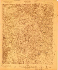
~ Aiken SC topo map, 1:48000 scale, 15 X 15 Minute, Historical, 1920
Aiken, South Carolina, USGS topographic map dated 1920.
Includes geographic coordinates (latitude and longitude). This topographic map is suitable for hiking, camping, and exploring, or framing it as a wall map.
Printed on-demand using high resolution imagery, on heavy weight and acid free paper, or alternatively on a variety of synthetic materials.
Topos available on paper, Waterproof, Poly, or Tyvek. Usually shipping rolled, unless combined with other folded maps in one order.
- Product Number: USGS-5659426
- Free digital map download (high-resolution, GeoPDF): Aiken, South Carolina (file size: 14 MB)
- Map Size: please refer to the dimensions of the GeoPDF map above
- Weight (paper map): ca. 55 grams
- Map Type: POD USGS Topographic Map
- Map Series: HTMC
- Map Verison: Historical
- Cell ID: 50372
- Scan ID: 261748
- Survey Year: 1919
- Datum: Unstated
- Map Projection: Unstated
- Advance: Yes
- Map published by United States Army Corps of Engineers
- Map published by United States Department of War
- Keywords: Overedge; Nonstandard Press Run
- Map Language: English
- Scanner Resolution: 600 dpi
- Map Cell Name: Aiken
- Grid size: 15 X 15 Minute
- Date on map: 1920
- Map Scale: 1:48000
- Geographical region: South Carolina, United States
Neighboring Maps:
All neighboring USGS topo maps are available for sale online at a variety of scales.
Spatial coverage:
Topo map Aiken, South Carolina, covers the geographical area associated the following places:
- Apia (historical) - Montmorenci - Ward Hills - Barclay Park - Ansley Park - Plunket (historical) - Aiken Estates - Dunbarton Oaks - Virginia Acres - Ridgecrest - Camp Long - Gem Lake Estates - Cardinal Park - Oakwood - Merritts Bridge (historical) - Nicholson Village - Balltown - Pinecrest - Dogwood Manor - Forest Heights - Forrest Park - Roseland - Crosland Park - Couchton - Aiken - Oak Grove - Hillview - Croft - Camp Gravatt - Foxtown - Quail Hollow - Six Points - Robinwood Estates - Gatewood - Elmwood Park - Earle (historical) - Bonniview Estates - Shiloh Heights - Conger Woods - Millbrook Estates - Seiglers Crossroads - Silver Bluff Estates - Westwood - Hidden Haven
- Map Area ID: AREA33.7533.5-81.75-81.5
- Northwest corner Lat/Long code: USGSNW33.75-81.75
- Northeast corner Lat/Long code: USGSNE33.75-81.5
- Southwest corner Lat/Long code: USGSSW33.5-81.75
- Southeast corner Lat/Long code: USGSSE33.5-81.5
- Northern map edge Latitude: 33.75
- Southern map edge Latitude: 33.5
- Western map edge Longitude: -81.75
- Eastern map edge Longitude: -81.5


