
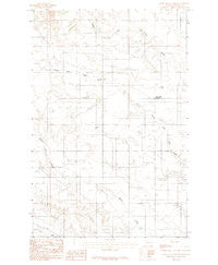
~ Deer Creek Church MT topo map, 1:24000 scale, 7.5 X 7.5 Minute, Historical, 1983, updated 1983
Deer Creek Church, Montana, USGS topographic map dated 1983.
Includes geographic coordinates (latitude and longitude). This topographic map is suitable for hiking, camping, and exploring, or framing it as a wall map.
Printed on-demand using high resolution imagery, on heavy weight and acid free paper, or alternatively on a variety of synthetic materials.
Topos available on paper, Waterproof, Poly, or Tyvek. Usually shipping rolled, unless combined with other folded maps in one order.
- Product Number: USGS-5658758
- Free digital map download (high-resolution, GeoPDF): Deer Creek Church, Montana (file size: 9 MB)
- Map Size: please refer to the dimensions of the GeoPDF map above
- Weight (paper map): ca. 55 grams
- Map Type: POD USGS Topographic Map
- Map Series: HTMC
- Map Verison: Historical
- Cell ID: 11728
- Scan ID: 362836
- Imprint Year: 1983
- Woodland Tint: Yes
- Aerial Photo Year: 1975
- Edit Year: 1983
- Field Check Year: 1977
- Datum: NAD27
- Map Projection: Lambert Conformal Conic
- Provisional map: Yes
- Map published by United States Geological Survey
- Map Language: English
- Scanner Resolution: 600 dpi
- Map Cell Name: Deer Creek Church
- Grid size: 7.5 X 7.5 Minute
- Date on map: 1983
- Map Scale: 1:24000
- Geographical region: Montana, United States
Neighboring Maps:
All neighboring USGS topo maps are available for sale online at a variety of scales.
Spatial coverage:
Topo map Deer Creek Church, Montana, covers the geographical area associated the following places:
- 17N51E02DDD_01 Well - West Church Cemetery - Slagsvold School (historical) - Bickness School (historical) - 18N51E28DDD_01 Well - 18N51E03DDA_01 Well - Spring Valley School (historical) - 18N51E15CC__01 Well - Deer Creek Church - Bradbury School (historical) - 18N51E34DAA_01 Well - 19N51E17DDA_01 Well - Centerville School (historical) - 19N51E35CAA_01 Well - 18N51E13DAA_01 Well
- Map Area ID: AREA47.37547.25-105.25-105.125
- Northwest corner Lat/Long code: USGSNW47.375-105.25
- Northeast corner Lat/Long code: USGSNE47.375-105.125
- Southwest corner Lat/Long code: USGSSW47.25-105.25
- Southeast corner Lat/Long code: USGSSE47.25-105.125
- Northern map edge Latitude: 47.375
- Southern map edge Latitude: 47.25
- Western map edge Longitude: -105.25
- Eastern map edge Longitude: -105.125


