
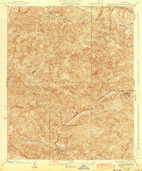
~ Warm Spring CA topo map, 1:24000 scale, 7.5 X 7.5 Minute, Historical, 1936, updated 1943
Warm Spring, California, USGS topographic map dated 1936.
Includes geographic coordinates (latitude and longitude). This topographic map is suitable for hiking, camping, and exploring, or framing it as a wall map.
Printed on-demand using high resolution imagery, on heavy weight and acid free paper, or alternatively on a variety of synthetic materials.
Topos available on paper, Waterproof, Poly, or Tyvek. Usually shipping rolled, unless combined with other folded maps in one order.
- Product Number: USGS-5658125
- Free digital map download (high-resolution, GeoPDF): Warm Spring, California (file size: 14 MB)
- Map Size: please refer to the dimensions of the GeoPDF map above
- Weight (paper map): ca. 55 grams
- Map Type: POD USGS Topographic Map
- Map Series: HTMC
- Map Verison: Historical
- Cell ID: 395918
- Scan ID: 301200
- Imprint Year: 1943
- Survey Year: 1931
- Datum: NAD
- Map Projection: Polyconic
- Map published by United States Geological Survey
- Map Language: English
- Scanner Resolution: 600 dpi
- Map Cell Name: Warm Spring
- Grid size: 7.5 X 7.5 Minute
- Date on map: 1936
- Map Scale: 1:24000
- Geographical region: California, United States
Neighboring Maps:
All neighboring USGS topo maps are available for sale online at a variety of scales.
Spatial coverage:
Topo map Warm Spring, California, covers the geographical area associated the following places:
- Lower Shake Campground - Little Burnt Peak - Sawtooth Mountain - South Tule Canyon - Kleine Canyon - Warm Springs Camp - Turkey Canyon - Tule Target Shooting Area - Prospect Campground - North Fork Fish Canyon - Elizabeth Lake Canyon Campground - Pine Canyon Ranger Station - Warm Springs Canyon - Red Fox Canyon - Burnt Peak Canyon - Fish Creek - Warm Springs Divide Truck Trail - The Potholes - Sawmill Mountain - Upper Shake Campground - Ruby Canyon - Burnt Peak Trail - Lion Canyon - Cottonwood Campground - Maxwell Mine - Burnt Peak - Prospect Canyon
- Map Area ID: AREA34.734.6-118.6-118.5
- Northwest corner Lat/Long code: USGSNW34.7-118.6
- Northeast corner Lat/Long code: USGSNE34.7-118.5
- Southwest corner Lat/Long code: USGSSW34.6-118.6
- Southeast corner Lat/Long code: USGSSE34.6-118.5
- Northern map edge Latitude: 34.7
- Southern map edge Latitude: 34.6
- Western map edge Longitude: -118.6
- Eastern map edge Longitude: -118.5


