
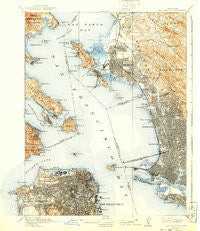
~ San Francisco CA topo map, 1:62500 scale, 15 X 15 Minute, Historical, 1915
San Francisco, California, USGS topographic map dated 1915.
Includes geographic coordinates (latitude and longitude). This topographic map is suitable for hiking, camping, and exploring, or framing it as a wall map.
Printed on-demand using high resolution imagery, on heavy weight and acid free paper, or alternatively on a variety of synthetic materials.
Topos available on paper, Waterproof, Poly, or Tyvek. Usually shipping rolled, unless combined with other folded maps in one order.
- Product Number: USGS-5657933
- Free digital map download (high-resolution, GeoPDF): San Francisco, California (file size: 11 MB)
- Map Size: please refer to the dimensions of the GeoPDF map above
- Weight (paper map): ca. 55 grams
- Map Type: POD USGS Topographic Map
- Map Series: HTMC
- Map Verison: Historical
- Cell ID: 62077
- Scan ID: 298897
- Visual Version Number: 1
- Survey Year: 1894
- Datum: Unstated
- Map Projection: Polyconic
- Map published by United States Geological Survey
- Keywords: Overedge
- Map Language: English
- Scanner Resolution: 600 dpi
- Map Cell Name: San Francisco
- Grid size: 15 X 15 Minute
- Date on map: 1915
- Map Scale: 1:62500
- Geographical region: California, United States
Neighboring Maps:
All neighboring USGS topo maps are available for sale online at a variety of scales.
Spatial coverage:
Topo map San Francisco, California, covers the geographical area associated the following places:
- Tara Hills - Montalvin - Seacliff - Pacific Heights - Kensington - Sydney Town (historical) - Friendship Village - West End - Tiburon - Haight-Ashbury - Rollingwood - San Francisco - Malcolm X Square - Woodstock - Normandy Village - North Richmond - Potrero District - El Sobrante - West Oakland - Hilarita - Golden Gate Heights - Opera Plaza - East Richmond Heights - Thomas Paine Square - Nystrom Village - Jordan Park - Peralta Villa - Fort Winfield Scott - El Campo - East Richmond - West Berkeley - North Beach - South Berkeley - Amanico Ergina Village - Saint Francis Square - Marina District - Martin Luther King Square - Chinatown - Frederick Douglass Haynes Gardens - Triangle Court - Fort McDowell - La Loma Park - Richmond - Belvedere - Mission District - University Village - Thousand Oaks - Banneker Homes - Park View Commons - Bel Aire - Berkeley - Rheem - Oakland - Presidio Terrace - Loren Miller Homes - El Cerrito - Albany - Richmond District - Rochedale Village - Little Osaka - Bayside Village - North Point Public Housing - Western Addition - Doelger City - Westbrae - Clinton (historical) - Point Richmond - Forest Knolls - McNears Beach - Sausalito - Easter Hill Village - San Quentin - Chinatown - Marcus Garvey Square - San Pablo - Paradise Cay - South Shore - Campbell Village - Stege - Cragmont - Laguna Heights - Little Italy - Little Reed Heights - Sunset District - Valencia Gardens - Victoria Mews - Adams Point - Belvedere Island - Giant - Cragmont - Atchison Village - Emeryville
- Map Area ID: AREA3837.75-122.5-122.25
- Northwest corner Lat/Long code: USGSNW38-122.5
- Northeast corner Lat/Long code: USGSNE38-122.25
- Southwest corner Lat/Long code: USGSSW37.75-122.5
- Southeast corner Lat/Long code: USGSSE37.75-122.25
- Northern map edge Latitude: 38
- Southern map edge Latitude: 37.75
- Western map edge Longitude: -122.5
- Eastern map edge Longitude: -122.25


