
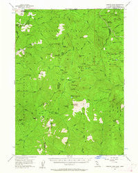
~ Preston Peak CA topo map, 1:62500 scale, 15 X 15 Minute, Historical, 1956, updated 1962
Preston Peak, California, USGS topographic map dated 1956.
Includes geographic coordinates (latitude and longitude). This topographic map is suitable for hiking, camping, and exploring, or framing it as a wall map.
Printed on-demand using high resolution imagery, on heavy weight and acid free paper, or alternatively on a variety of synthetic materials.
Topos available on paper, Waterproof, Poly, or Tyvek. Usually shipping rolled, unless combined with other folded maps in one order.
- Product Number: USGS-5657859
- Free digital map download (high-resolution, GeoPDF): Preston Peak, California (file size: 10 MB)
- Map Size: please refer to the dimensions of the GeoPDF map above
- Weight (paper map): ca. 55 grams
- Map Type: POD USGS Topographic Map
- Map Series: HTMC
- Map Verison: Historical
- Cell ID: 61288
- Scan ID: 298675
- Imprint Year: 1962
- Woodland Tint: Yes
- Aerial Photo Year: 1951
- Field Check Year: 1956
- Datum: NAD27
- Map Projection: Polyconic
- Map published by United States Geological Survey
- Keywords: Overedge
- Map Language: English
- Scanner Resolution: 600 dpi
- Map Cell Name: Preston Peak
- Grid size: 15 X 15 Minute
- Date on map: 1956
- Map Scale: 1:62500
- Geographical region: California, United States
Neighboring Maps:
All neighboring USGS topo maps are available for sale online at a variety of scales.
Spatial coverage:
Topo map Preston Peak, California, covers the geographical area associated the following places:
- Poker Creek - Little Sanger Peak - Sanger Peak - Bear Mountain - Black Butte - Elk Lake - Cracker Meadows - Bear Paw - Lookout Mountain - Rocky Knob - Bear Cub - Bell Echo Camp - Haystack - Prescott Cabin - Cedar Crest - Twin Valley Creek - Wounded Knee Mountain - Poker Flat - Whisky Lake - Youngs Peak - Black Creek - Little Buck Ridge - Preston Creek - Rattlesnake Meadow - Hazel View Summit - Trout Camp - Chicago Peak - Twin Valley - Siskiyou Pass - Brushy Creek - Little Grayback - Camp Chicago - Island Lake - Kelly Lake - Twin Peaks - Raspberry Lake - Louse Creek - Little Preston - Broken Kettle Creek - Copper Creek - Youngs Valley - Porters Camp - Mud Lake - Laurel Butte - Little Bear Basin - Elk Valley Recreation Site - North Fork Dunn Creek - Elk Lick - Preston Peak - Chicago Creek - Stevens Camp - Cedar Basin - Copper Mountain - Elk Lick Ridge - Bear Wallow - Cyclone Gap - Big Buck Ridge - Loretta Falls - Wilderness Falls - Orloff Mine - Doe Flat - Knopti Creek - Sanger Lake - The Lieutenants - Five-and-Ten Divide - Craker Meadows - Bear Basin - Randolph Collier Tunnel - Crazy Peak - Hardscrabble - Buck Lake - Polar Bear Mountain - Boulder Peak - Dunn Creek - Jedediah Mountain - Bear Basin Butte - Sanger Canyon - El Capitan - Siskiyou Mountains - West Fork Clear Creek - Cedar Creek - Doe Creek - Little South Fork Indian Creek - Bybee Gulch - Broken Rib Mountain - Packers Creek - Devils Punchbowl - Maple Creek
- Map Area ID: AREA4241.75-123.75-123.5
- Northwest corner Lat/Long code: USGSNW42-123.75
- Northeast corner Lat/Long code: USGSNE42-123.5
- Southwest corner Lat/Long code: USGSSW41.75-123.75
- Southeast corner Lat/Long code: USGSSE41.75-123.5
- Northern map edge Latitude: 42
- Southern map edge Latitude: 41.75
- Western map edge Longitude: -123.75
- Eastern map edge Longitude: -123.5


