
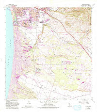
~ Oceano CA topo map, 1:24000 scale, 7.5 X 7.5 Minute, Historical, 1965, updated 1994
Oceano, California, USGS topographic map dated 1965.
Includes geographic coordinates (latitude and longitude). This topographic map is suitable for hiking, camping, and exploring, or framing it as a wall map.
Printed on-demand using high resolution imagery, on heavy weight and acid free paper, or alternatively on a variety of synthetic materials.
Topos available on paper, Waterproof, Poly, or Tyvek. Usually shipping rolled, unless combined with other folded maps in one order.
- Product Number: USGS-5657823
- Free digital map download (high-resolution, GeoPDF): Oceano, California (file size: 15 MB)
- Map Size: please refer to the dimensions of the GeoPDF map above
- Weight (paper map): ca. 55 grams
- Map Type: POD USGS Topographic Map
- Map Series: HTMC
- Map Verison: Historical
- Cell ID: 32869
- Scan ID: 293649
- Imprint Year: 1994
- Woodland Tint: Yes
- Photo Revision Year: 1994
- Aerial Photo Year: 1987
- Edit Year: 1994
- Datum: NAD27
- Map Projection: Lambert Conformal Conic
- Map published by United States Geological Survey
- Map Language: English
- Scanner Resolution: 600 dpi
- Map Cell Name: Oceano
- Grid size: 7.5 X 7.5 Minute
- Date on map: 1965
- Map Scale: 1:24000
- Geographical region: California, United States
Neighboring Maps:
All neighboring USGS topo maps are available for sale online at a variety of scales.
Spatial coverage:
Topo map Oceano, California, covers the geographical area associated the following places:
- Grande Mobile Manor Mobile Home Park - Bromela - Fairoaks - Rancho del Arroyo Mobile Home Park - Oaks - Newsom Springs - Summit (historical) - Cienega Seabreeze Mobile Home Park - Cuna Vista Mobile Home Park - Arroyo Grande - Oceano Beach - Halcyon - Portico Mobile Home and Garden Park - Los Berros - Ken Mar Gardens Mobile Home Park - Grover Beach - Callender - ARroyo Trailer Park - Oceano
- Map Area ID: AREA35.12535-120.6416667-120.5
- Northwest corner Lat/Long code: USGSNW35.125-120.6416667
- Northeast corner Lat/Long code: USGSNE35.125-120.5
- Southwest corner Lat/Long code: USGSSW35-120.6416667
- Southeast corner Lat/Long code: USGSSE35-120.5
- Northern map edge Latitude: 35.125
- Southern map edge Latitude: 35
- Western map edge Longitude: -120.6416667
- Eastern map edge Longitude: -120.5


