
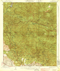
~ Mt Lowe CA topo map, 1:24000 scale, 7.5 X 7.5 Minute, Historical, 1939, updated 1939
Mt Lowe, California, USGS topographic map dated 1939.
Includes geographic coordinates (latitude and longitude). This topographic map is suitable for hiking, camping, and exploring, or framing it as a wall map.
Printed on-demand using high resolution imagery, on heavy weight and acid free paper, or alternatively on a variety of synthetic materials.
Topos available on paper, Waterproof, Poly, or Tyvek. Usually shipping rolled, unless combined with other folded maps in one order.
- Product Number: USGS-5657793
- Free digital map download (high-resolution, GeoPDF): Mt Lowe, California (file size: 14 MB)
- Map Size: please refer to the dimensions of the GeoPDF map above
- Weight (paper map): ca. 55 grams
- Map Type: POD USGS Topographic Map
- Map Series: HTMC
- Map Verison: Historical
- Cell ID: 395949
- Scan ID: 293327
- Imprint Year: 1939
- Woodland Tint: Yes
- Survey Year: 1936
- Datum: NAD
- Map Projection: Polyconic
- Map published by United States Geological Survey
- Map Language: English
- Scanner Resolution: 600 dpi
- Map Cell Name: Mount Lowe
- Grid size: 7.5 X 7.5 Minute
- Date on map: 1939
- Map Scale: 1:24000
- Geographical region: California, United States
Neighboring Maps:
All neighboring USGS topo maps are available for sale online at a variety of scales.
Spatial coverage:
Topo map Mt Lowe, California, covers the geographical area associated the following places:
- Nino Picnic Area - Mount Lowe Academy - La Canada Flintridge Branch Los Angeles County Public Library - Bear Canyon - Brown Canyon - Nike Site LA-09C (historical) - Dark Canyon - CCC Ridge - Echo Mountain Picnic Area - Gould Canyon - Oakwide Picnic Area - Big Tujunga Number 1 32-006 Dam - Chiquita Canyon - Sunset Ridge Station - Hansen Canyon - Pine Canyon - La Canada Presbyterian Church - La Canada Flintridge Post Office - Josephine Peak - Mesa Heliport - Big Tujunga Reservoir - Mount Disappointment - Cloudburst Canyon - Clear Creek Station - Falls Canyon - Switzer Camp - Maple Canyon - Sam Merrill Trail - Ladybug Canyon - Saint George's Episcopal Church - Upper Switzer Campground - Mount Lawlor - Nino Canyon - La Canada Water Reclamation Plant - Bear Canyon Picnic Area - Grand Canyon - Twin Canyon - Las Flores Canyon - Fern Canyon - Josephine Saddle - Little Bear Canyon - Hoyt Mountain - Angeles Crest Station - Colby Canyon - Daisy Canyon - Echo Mountain - Inspiration Point - Paul Little Picnic Area - West Ravine - The Pines Picnic Area - Switzer Visitor Information Station - Woodwardia Canyon - Twenty-Five Foot Space Simulator - Loma Alta Park - Loma Alta Elementary School - Red Box Station - La Vina Hospital and Sanitorium - Plaza De La Canada Shopping Center - Camp Sierra - Camp Chiquita - Crystal Spring (historical) - Paradise Canyon - Mount Lowe - Mount Lowe Railway Historical Marker - Jet Propulsion Laboratory - Strawberry Peak - Saucer Branch - Red Box Gap - Breakneck Canyon - Castle Canyon - Switzer Station - Millard Canyon - Brown Mountain - Gould Mesa Picnic Area - Lower Switzer Campground - Clear Creek - Georges Gap - Farnsworth Park - La Canada Country Club - El Prieto Canyon - Millard Picnic Area - Clear Creek School Camp - Las Casetas (historical) - Mount Lowe Campground - Big Tujunga Dam - Muir Peak - Paradise Canyon Elementary School - Long Canyon - Agua Canyon
- Map Area ID: AREA34.334.2-118.2-118.1
- Northwest corner Lat/Long code: USGSNW34.3-118.2
- Northeast corner Lat/Long code: USGSNE34.3-118.1
- Southwest corner Lat/Long code: USGSSW34.2-118.2
- Southeast corner Lat/Long code: USGSSE34.2-118.1
- Northern map edge Latitude: 34.3
- Southern map edge Latitude: 34.2
- Western map edge Longitude: -118.2
- Eastern map edge Longitude: -118.1


