
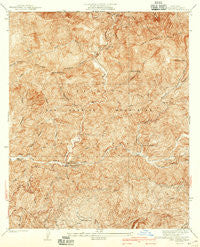
~ Camp Bonita CA topo map, 1:24000 scale, 7.5 X 7.5 Minute, Historical, 1940
Camp Bonita, California, USGS topographic map dated 1940.
Includes geographic coordinates (latitude and longitude). This topographic map is suitable for hiking, camping, and exploring, or framing it as a wall map.
Printed on-demand using high resolution imagery, on heavy weight and acid free paper, or alternatively on a variety of synthetic materials.
Topos available on paper, Waterproof, Poly, or Tyvek. Usually shipping rolled, unless combined with other folded maps in one order.
- Product Number: USGS-5657413
- Free digital map download (high-resolution, GeoPDF): Camp Bonita, California (file size: 14 MB)
- Map Size: please refer to the dimensions of the GeoPDF map above
- Weight (paper map): ca. 55 grams
- Map Type: POD USGS Topographic Map
- Map Series: HTMC
- Map Verison: Historical
- Cell ID: 395981
- Scan ID: 288853
- Survey Year: 1934
- Datum: NAD
- Map Projection: Polyconic
- Map published by United States Geological Survey
- Map Language: English
- Scanner Resolution: 600 dpi
- Map Cell Name: Camp Bonita
- Grid size: 7.5 X 7.5 Minute
- Date on map: 1940
- Map Scale: 1:24000
- Geographical region: California, United States
Neighboring Maps:
All neighboring USGS topo maps are available for sale online at a variety of scales.
Spatial coverage:
Topo map Camp Bonita, California, covers the geographical area associated the following places:
- Oaks Picnic Area - Fern Canyon Trail - Widman Ranch - Williams Camp - Thompson Flat - Horse Canyon - Heaton Flat Trail - East Fork Station - Devil Gulch - Allison Trail - The Narrows - Camp Bonita - Hudson Bay Camp - Williams Flat - Detention Camp - Iron Mountain - Coyote Flat - Peacock Canyon - Clark Gulch - Peacock Saddle - Weber Camp - Cow Canyon - Rattlesnake Canyon - Cape Horn Canyon - Shoemaker Canyon - Dime Canyon - Coldwater Canyon Truck Trail - Cattle Canyon - Laurel Gulch - East Fork Horse Canyon - Blind Canyon - Fossil Canyon - Baldora Mine - Rattlesnake Peak - Hummingbird Creek - Doe Flat - Allison Mine - Stanley-Miller Mine - Eldoradoville Campground - Iron Fork - Heaton Flat - Williams Canyon - Swan Rock - Coldwater Canyon - Airplane Flat - Allison Gulch - Dry Gulch - Iron Fork Camp - Thompson Ranch - Oak Canyon - San Gabriel Guard Station (historical) - Tanbark Flats - Widco Mine
- Map Area ID: AREA34.334.2-117.8-117.7
- Northwest corner Lat/Long code: USGSNW34.3-117.8
- Northeast corner Lat/Long code: USGSNE34.3-117.7
- Southwest corner Lat/Long code: USGSSW34.2-117.8
- Southeast corner Lat/Long code: USGSSE34.2-117.7
- Northern map edge Latitude: 34.3
- Southern map edge Latitude: 34.2
- Western map edge Longitude: -117.8
- Eastern map edge Longitude: -117.7


