
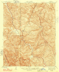
~ Beartrap Canyon CA topo map, 1:24000 scale, 7.5 X 7.5 Minute, Historical, 1938, updated 1948
Beartrap Canyon, California, USGS topographic map dated 1938.
Includes geographic coordinates (latitude and longitude). This topographic map is suitable for hiking, camping, and exploring, or framing it as a wall map.
Printed on-demand using high resolution imagery, on heavy weight and acid free paper, or alternatively on a variety of synthetic materials.
Topos available on paper, Waterproof, Poly, or Tyvek. Usually shipping rolled, unless combined with other folded maps in one order.
- Product Number: USGS-5657349
- Free digital map download (high-resolution, GeoPDF): Beartrap Canyon, California (file size: 13 MB)
- Map Size: please refer to the dimensions of the GeoPDF map above
- Weight (paper map): ca. 55 grams
- Map Type: POD USGS Topographic Map
- Map Series: HTMC
- Map Verison: Historical
- Cell ID: 395902
- Scan ID: 288269
- Imprint Year: 1948
- Edit Year: 1947
- Survey Year: 1932
- Datum: NAD
- Map Projection: Polyconic
- Map published by United States Geological Survey
- Map Language: English
- Scanner Resolution: 600 dpi
- Map Cell Name: Beartrap Canyon
- Grid size: 7.5 X 7.5 Minute
- Date on map: 1938
- Map Scale: 1:24000
- Geographical region: California, United States
Neighboring Maps:
All neighboring USGS topo maps are available for sale online at a variety of scales.
Spatial coverage:
Topo map Beartrap Canyon, California, covers the geographical area associated the following places:
- Emigrant Landing - Beartrap Canyon - Liebre Gulch Maintenance Station (historical) - William E Warne Power Plant - Angeles Tunnel - Beartrap Picnic Area - Osito Canyon - Liebre Gulch - Reservoir Hill - Priest - Cañada de los Alamos - Serrano Picnic Area - Halfway Inn - Nugget Point - Coyote Canyon - Oak Flats - Cold Canyon - Glory Hole - Slide Mountain - Slide Mountain Lookout - Tin Cup Picnic Area - Pyramid 1-066 Dam - Pyramid Lake - Pyramid Rock - Spanish Point - Beartrap Spring - Reservoir Summit - Vaquero Picnic Area - Fish Creek - Posey Canyon - Quarry Spring - Liebre Pumping Station (historical) - Royball Spring - Yellow Bar Picnic Area - Lost Mine - Gorman Creek - Piru Gorge - Emigrant Landing Picnic Area - Carlos Canyon - Apple Canyon - Frenchmans Flat Campground - Chumash Island - Side Hill Siphon - West Fork Liebre Gulch - Bailey Trail - Frenchmans Flat - Cherry Canyon
- Map Area ID: AREA34.734.6-118.8-118.7
- Northwest corner Lat/Long code: USGSNW34.7-118.8
- Northeast corner Lat/Long code: USGSNE34.7-118.7
- Southwest corner Lat/Long code: USGSSW34.6-118.8
- Southeast corner Lat/Long code: USGSSE34.6-118.7
- Northern map edge Latitude: 34.7
- Southern map edge Latitude: 34.6
- Western map edge Longitude: -118.8
- Eastern map edge Longitude: -118.7


