
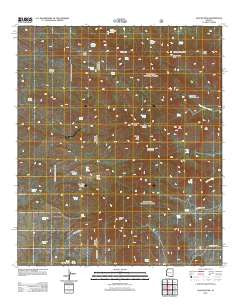
~ Apache Peak AZ topo map, 1:24000 scale, 7.5 X 7.5 Minute, Historical, 2012
Apache Peak, Arizona, USGS topographic map dated 2012.
Includes geographic coordinates (latitude and longitude). This topographic map is suitable for hiking, camping, and exploring, or framing it as a wall map.
Printed on-demand using high resolution imagery, on heavy weight and acid free paper, or alternatively on a variety of synthetic materials.
Topos available on paper, Waterproof, Poly, or Tyvek. Usually shipping rolled, unless combined with other folded maps in one order.
- Product Number: USGS-5641732
- Free digital map download (high-resolution, GeoPDF): Apache Peak, Arizona (file size: 29 MB)
- Map Size: please refer to the dimensions of the GeoPDF map above
- Weight (paper map): ca. 55 grams
- Map Type: POD USGS Topographic Map
- Map Series: US Topo
- Map Verison: Historical
- Cell ID: 1244
- Datum: North American Datum of 1983
- Map Projection: Transverse Mercator
- Map Cell Name: Apache Peak
- Grid size: 7.5 X 7.5 Minute
- Date on map: 2012
- Map Scale: 1:24000
- Geographical region: Arizona, United States
Neighboring Maps:
All neighboring USGS topo maps are available for sale online at a variety of scales.
Spatial coverage:
Topo map Apache Peak, Arizona, covers the geographical area associated the following places:
- Goat Well - Wild Cow Canyon - Bear Spring - Boulder Tank - French Joe Peak - Shellenberger Trick Tank - East Peak - Cottonwood Trick Tank - Hidden Springs - Lower Bear Spring - French Joe Spring - White Wing Spring - Dry Canyon Well - Cottonwood Saddle - Dry Canyon Spring - Willow Spring - Lower Wakefield Spring - Christmas Tank - Middle Wakefield Spring - Upper Wakefield Spring - Lone Pine Saddle - Ramsey Well - Bootlegger Spring - Death Trap Spring - Death Trap Canyon - Maverick Well - Lobo Pass - Glenn Spring - Cottonwood Peak - Granite Peak - Cottonwood Spring - Burro Gap - The Cape - Goat Well - Blacktail Spring - South Fork Middle Canyon - Juniper Spring - Middle Dry Tank - New Dry Canyon Trick Tank - Upper Guindani Trick Tank - Whetstone Mountains - Basin Spring - Wild Cow Spring - Middle Tank - Dripping Spring - Great Spring Tank - Goat Spring - Upper Dry Tank - Copper Sands Well - Simpson Spring - East Peak Trick Tank - Glenn Spring - Mine Canyon Trick Tank - French Joe Trick Tank - Coyote Spring - Hardwater Spring - Willow Canyon - Wakefield Northeast Tank - Cement Trough Spring - Apache Peak - Apache Spring - Burro Spring - McNalley Tank - Upper Tank - Bathtub Spring - Iron Spring - Clyne Well
- Map Area ID: AREA31.87531.75-110.5-110.375
- Northwest corner Lat/Long code: USGSNW31.875-110.5
- Northeast corner Lat/Long code: USGSNE31.875-110.375
- Southwest corner Lat/Long code: USGSSW31.75-110.5
- Southeast corner Lat/Long code: USGSSE31.75-110.375
- Northern map edge Latitude: 31.875
- Southern map edge Latitude: 31.75
- Western map edge Longitude: -110.5
- Eastern map edge Longitude: -110.375


