
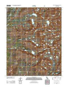
~ Mount Whitney CA topo map, 1:24000 scale, 7.5 X 7.5 Minute, Historical, 2012
Mount Whitney, California, USGS topographic map dated 2012.
Includes geographic coordinates (latitude and longitude). This topographic map is suitable for hiking, camping, and exploring, or framing it as a wall map.
Printed on-demand using high resolution imagery, on heavy weight and acid free paper, or alternatively on a variety of synthetic materials.
Topos available on paper, Waterproof, Poly, or Tyvek. Usually shipping rolled, unless combined with other folded maps in one order.
- Product Number: USGS-5640816
- Free digital map download (high-resolution, GeoPDF): Mount Whitney, California (file size: 22 MB)
- Map Size: please refer to the dimensions of the GeoPDF map above
- Weight (paper map): ca. 55 grams
- Map Type: POD USGS Topographic Map
- Map Series: US Topo
- Map Verison: Historical
- Cell ID: 30897
- Datum: North American Datum of 1983
- Map Projection: Transverse Mercator
- Map Cell Name: Mount Whitney
- Grid size: 7.5 X 7.5 Minute
- Date on map: 2012
- Map Scale: 1:24000
- Geographical region: California, United States
Neighboring Maps:
All neighboring USGS topo maps are available for sale online at a variety of scales.
Spatial coverage:
Topo map Mount Whitney, California, covers the geographical area associated the following places:
- Thor Peak - Mount Newcomb - Mount Hale - Crabtree Creek - Tunnabora Peak - Mount Marsh - Mount Pickering - The Miter - Mount Hitchcock - Wallace Lake - Timberline Lake - Keeler Needle - Guyot Flat - Discovery Pinnacle - Primrose Lake - Hitchcock Lakes - Erin Lake - Crooks Peak - Joe Devel Peak - Guitar Lake - Clyde Meadow - Mount McAdie - Lower Boy Scout Lake - Mount Chamberlin - Mount Young - Crabtree Lakes - Mount Guyot - Mount Muir - Mount Whitney Trail - Sky Blue Lake - Mount Irvine - Mount Whitney - Arc Pass - Pinnacle Ridge - Bighorn Park - Vacation Pass - Wotans Throne - Upper Boy Scout Lake - Consultation Lake - Trail Crest - Arctic Lake - Meysan Lake - Crabtree Ranger Station - Mount Mallory - Mount Russell - Sheep Pass (historical) - Crabtree Meadow - Mount Carillon - Crabtree Pass - The Major General - Frog Pond - Sandy Meadow - Wales Lake - Mount Corcoran - Mount Le Conte - Sierra Nevada - Tulainyo Lake - Mirror Lake - Iridescent Lake - Whitney Pass
- Map Area ID: AREA36.62536.5-118.375-118.25
- Northwest corner Lat/Long code: USGSNW36.625-118.375
- Northeast corner Lat/Long code: USGSNE36.625-118.25
- Southwest corner Lat/Long code: USGSSW36.5-118.375
- Southeast corner Lat/Long code: USGSSE36.5-118.25
- Northern map edge Latitude: 36.625
- Southern map edge Latitude: 36.5
- Western map edge Longitude: -118.375
- Eastern map edge Longitude: -118.25


