
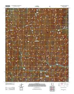
~ Portal Peak AZ topo map, 1:24000 scale, 7.5 X 7.5 Minute, Historical, 2012
Portal Peak, Arizona, USGS topographic map dated 2012.
Includes geographic coordinates (latitude and longitude). This topographic map is suitable for hiking, camping, and exploring, or framing it as a wall map.
Printed on-demand using high resolution imagery, on heavy weight and acid free paper, or alternatively on a variety of synthetic materials.
Topos available on paper, Waterproof, Poly, or Tyvek. Usually shipping rolled, unless combined with other folded maps in one order.
- Product Number: USGS-5640656
- Free digital map download (high-resolution, GeoPDF): Portal Peak, Arizona (file size: 34 MB)
- Map Size: please refer to the dimensions of the GeoPDF map above
- Weight (paper map): ca. 55 grams
- Map Type: POD USGS Topographic Map
- Map Series: US Topo
- Map Verison: Historical
- Cell ID: 36085
- Datum: North American Datum of 1983
- Map Projection: Transverse Mercator
- Map Cell Name: Portal Peak
- Grid size: 7.5 X 7.5 Minute
- Date on map: 2012
- Map Scale: 1:24000
- Geographical region: Arizona, United States
Neighboring Maps:
All neighboring USGS topo maps are available for sale online at a variety of scales.
Spatial coverage:
Topo map Portal Peak, Arizona, covers the geographical area associated the following places:
- Log Spring - Horseshoe Pass - Maple Camp - Pothole Canyon - Portal Tank - Roush Ranch - Warren Well - Blevins Draw - Jones Peak - South Fork Canyon Trail Two Hundred Fortythree - Horseshoe Tank Number One - Horseshoe Tank Number Four - Licklog Tank - Little North Fork Tank - Jones Ridge - Sulphur Peak - Bird Tank - Monte Vista Peak Lookout - Sulphur Spring - Horseshoe Tank Number Three - Red Rock Tank - Pothole Peak - Herb Martyr Forest Camp - Dripping Spring - Portal Peak - Basin Trail Two Hundred Fortyseven - North Tank - Jack Wood Pass - Horseshoe Tank Number Two - Burro Spring - Darnell Peak - Pothole Tank - South Fork Forest Camp - Sentinel Peak - Jack Wood Tank - Kambitsch Tank - Snowshed Trail - North Fork Canyon - Mountaintop Tank - Icebox Tank
- Map Area ID: AREA31.87531.75-109.25-109.125
- Northwest corner Lat/Long code: USGSNW31.875-109.25
- Northeast corner Lat/Long code: USGSNE31.875-109.125
- Southwest corner Lat/Long code: USGSSW31.75-109.25
- Southeast corner Lat/Long code: USGSSE31.75-109.125
- Northern map edge Latitude: 31.875
- Southern map edge Latitude: 31.75
- Western map edge Longitude: -109.25
- Eastern map edge Longitude: -109.125


