
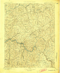
~ Kanawha Falls WV topo map, 1:125000 scale, 30 X 30 Minute, Historical, 1900
Kanawha Falls, West Virginia, USGS topographic map dated 1900.
Includes geographic coordinates (latitude and longitude). This topographic map is suitable for hiking, camping, and exploring, or framing it as a wall map.
Printed on-demand using high resolution imagery, on heavy weight and acid free paper, or alternatively on a variety of synthetic materials.
Topos available on paper, Waterproof, Poly, or Tyvek. Usually shipping rolled, unless combined with other folded maps in one order.
- Product Number: USGS-5638725
- Free digital map download (high-resolution, GeoPDF): Kanawha Falls, West Virginia (file size: 11 MB)
- Map Size: please refer to the dimensions of the GeoPDF map above
- Weight (paper map): ca. 55 grams
- Map Type: POD USGS Topographic Map
- Map Series: HTMC
- Map Verison: Historical
- Cell ID: 395870
- Scan ID: 253985
- Survey Year: 1895
- Datum: Unstated
- Map Projection: Unstated
- Map published by United States Geological Survey
- Map Language: English
- Scanner Resolution: 600 dpi
- Map Cell Name: Kanawha Falls
- Grid size: 30 X 30 Minute
- Date on map: 1900
- Map Scale: 1:125000
- Geographical region: West Virginia, United States
Neighboring Maps:
All neighboring USGS topo maps are available for sale online at a variety of scales.
Spatial coverage:
Topo map Kanawha Falls, West Virginia, covers the geographical area associated the following places:
- Gauley - Dry Branch - South Caperton - Varneytown - Hopewell - Bickmore - Mount Olive - Kanawha Falls - Two Run - Hamilton - Nuttalburg (historical) - Amelia - South Fayette - Lizemores - Cambria - Sharon - North Page - Boonesborough - Mulvane (historical) - KM Junction - Jamestown (historical) - Fayette Heights - Quick - Osborne - Odessa - Tad - Independence - Nuckolls - Bomont - Fivemile - Blakeley - Pond Fork - Gaymont - Hartland - Michigan (historical) - Porter - Crosby - Indore - South Nuttall (historical) - Wills - Ronda - Crown Hill - Pine Grove - Chelyan - Falls View - Fola - Crescent - Montgomery Heights - Carver (historical) - Hansford - Paxton - Carbon - Riverside - Youngs Bottom - Victor - Putney - London - Eagle - Triplett - Ames - Victor - Newlyn (historical) - Red Warrior - Coalridge - Morris (historical) - Elkridge - Rosina (historical) - Apgah (historical) - McDunn - Deep Water - Ansted - Jarrett - Elverton - Blue Creek - Marting - Oakton - Procious - Kelly Hill - Mount Carbon - Hollygrove - Dawes - Walgrove - Charlton Heights - Standard - Lick Fork - Elkview - Heatherman (historical) - Blount - Pond Gap - Lucas - Hico - Pratt - Alloy - Greendale - Cannelton - Powellton - Cabin Creek - Elkhurst - Lansing - Jarretts Ford
- Map Area ID: AREA38.538-81.5-81
- Northwest corner Lat/Long code: USGSNW38.5-81.5
- Northeast corner Lat/Long code: USGSNE38.5-81
- Southwest corner Lat/Long code: USGSSW38-81.5
- Southeast corner Lat/Long code: USGSSE38-81
- Northern map edge Latitude: 38.5
- Southern map edge Latitude: 38
- Western map edge Longitude: -81.5
- Eastern map edge Longitude: -81


