
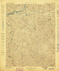
~ Huntington WV topo map, 1:125000 scale, 30 X 30 Minute, Historical, 1898
Huntington, West Virginia, USGS topographic map dated 1898.
Includes geographic coordinates (latitude and longitude). This topographic map is suitable for hiking, camping, and exploring, or framing it as a wall map.
Printed on-demand using high resolution imagery, on heavy weight and acid free paper, or alternatively on a variety of synthetic materials.
Topos available on paper, Waterproof, Poly, or Tyvek. Usually shipping rolled, unless combined with other folded maps in one order.
- Product Number: USGS-5638717
- Free digital map download (high-resolution, GeoPDF): Huntington, West Virginia (file size: 12 MB)
- Map Size: please refer to the dimensions of the GeoPDF map above
- Weight (paper map): ca. 55 grams
- Map Type: POD USGS Topographic Map
- Map Series: HTMC
- Map Verison: Historical
- Cell ID: 395874
- Scan ID: 253980
- Survey Year: 1890
- Datum: Unstated
- Map Projection: Unstated
- Map published by United States Geological Survey
- Map Language: English
- Scanner Resolution: 600 dpi
- Map Cell Name: Huntington
- Grid size: 30 X 30 Minute
- Date on map: 1898
- Map Scale: 1:125000
- Geographical region: West Virginia, United States
Neighboring Maps:
All neighboring USGS topo maps are available for sale online at a variety of scales.
Spatial coverage:
Topo map Huntington, West Virginia, covers the geographical area associated the following places:
- Guthrie - Midkiff - Inez - Fudges Creek - Lattin (historical) - Portersville - Martha - Jenks - Fair Place - Park Hills - Gillette - Belle Court - Bowen - Hubball - Beverly Hills - East Lynn - Yates Crossing - Dickson - Harts - Hager - Sias - Barboursville - Campbell Park - Rome - Lakeland - Atenville - Rolling Hills - Crockett - Malcolm Springs Heights - Sweetland - Wilson - Bartramville - Quaker - Kiahsville - Daisy - Thompson Heights - Ferrellsburg - Stamford Park - Corryville - Beverly Hills - Chancellor Hills - Gaylersville - Ridgewood - Garden Farms - Minerva - Timberlake - Huntington - Bartram (historical) - Booton - Sarah - Guyandotte - Edgemont - Whitaker Terrace - Coleman - Baber - Reid - Stiltner - Cuzzie - Brentwood - Washington Square - Blue Sulphur - Grandview Heights - Elmwood - Sidney - Hurricane - Spears (historical) - Spurlockville - Ranger - Pea Ridge - Mott - Lake Washington - Ferguson - Radnor - Home Park - Riverside Terrace - Proctorville - Winslow - Marcum Terrace - Brownstown (historical) - West Huntington - Fry - Imperial Estates - Getaway - Enslow Park Place - Echo - Fourteen (historical) - West Pea Ridge - Indian Meadows - Salt Rock - Gilkerson - Ardel - Genoa - Howells Mill - Hamlin - Le Mae - Cox Landing - Toney - Belmont Park - Northwood - Girard
- Map Area ID: AREA38.538-82.5-82
- Northwest corner Lat/Long code: USGSNW38.5-82.5
- Northeast corner Lat/Long code: USGSNE38.5-82
- Southwest corner Lat/Long code: USGSSW38-82.5
- Southeast corner Lat/Long code: USGSSE38-82
- Northern map edge Latitude: 38.5
- Southern map edge Latitude: 38
- Western map edge Longitude: -82.5
- Eastern map edge Longitude: -82


