
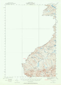
~ Sandy Bay ME topo map, 1:62500 scale, 15 X 15 Minute, Historical, 1927, updated 1964
Sandy Bay, Maine, USGS topographic map dated 1927.
Includes geographic coordinates (latitude and longitude). This topographic map is suitable for hiking, camping, and exploring, or framing it as a wall map.
Printed on-demand using high resolution imagery, on heavy weight and acid free paper, or alternatively on a variety of synthetic materials.
Topos available on paper, Waterproof, Poly, or Tyvek. Usually shipping rolled, unless combined with other folded maps in one order.
- Product Number: USGS-5638067
- Free digital map download (high-resolution, GeoPDF): Sandy Bay, Maine (file size: 4 MB)
- Map Size: please refer to the dimensions of the GeoPDF map above
- Weight (paper map): ca. 55 grams
- Map Type: POD USGS Topographic Map
- Map Series: HTMC
- Map Verison: Historical
- Cell ID: 62115
- Scan ID: 306754
- Imprint Year: 1964
- Survey Year: 1927
- Datum: NAD27
- Map Projection: Polyconic
- Map published by United States Geological Survey
- Map published by United States Army Corps of Engineers
- Keywords: Overedge
- Map Language: English
- Scanner Resolution: 600 dpi
- Map Cell Name: Sandy Bay
- Grid size: 15 X 15 Minute
- Date on map: 1927
- Map Scale: 1:62500
- Geographical region: Maine, United States
Neighboring Maps:
All neighboring USGS topo maps are available for sale online at a variety of scales.
Spatial coverage:
Topo map Sandy Bay, Maine, covers the geographical area associated the following places:
- Moose Mountain - Cape Horn Pond - Middle Grenier Pond - South Branch Camp - Blake Gore - T4 R5 NBKP - Little Grenier Pond - Fisher Ponds - Stony Brook - Sandy Bay Mountain - Hilton Farm - Sandy Bay Farm - Sandy Bay Township - Little Canada Falls - Fourmile Brook - Campbell Brook - Threemile Brook - South Branch Brook - Hall Pond - McKain Brook - Frost Pond Flowage - Township of Prentiss - No Name Pond - Williams Pond - Campbell Pond - Johns Pond - Grenier Pond - Number Two Mountain
- Map Area ID: AREA4645.75-70.5-70.25
- Northwest corner Lat/Long code: USGSNW46-70.5
- Northeast corner Lat/Long code: USGSNE46-70.25
- Southwest corner Lat/Long code: USGSSW45.75-70.5
- Southeast corner Lat/Long code: USGSSE45.75-70.25
- Northern map edge Latitude: 46
- Southern map edge Latitude: 45.75
- Western map edge Longitude: -70.5
- Eastern map edge Longitude: -70.25


