
~ Santa Cruz CA topo map, 1:250000 scale, 1 X 2 Degree, Historical, 1948, updated 1948
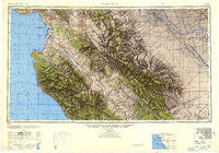
Santa Cruz, California, USGS topographic map dated 1948.
Includes geographic coordinates (latitude and longitude). This topographic map is suitable for hiking, camping, and exploring, or framing it as a wall map.
Printed on-demand using high resolution imagery, on heavy weight and acid free paper, or alternatively on a variety of synthetic materials.
Topos available on paper, Waterproof, Poly, or Tyvek. Usually shipping rolled, unless combined with other folded maps in one order.
- Product Number: USGS-5637673
- Free digital map download (high-resolution, GeoPDF): Santa Cruz, California (file size: 17 MB)
- Map Size: please refer to the dimensions of the GeoPDF map above
- Weight (paper map): ca. 55 grams
- Map Type: POD USGS Topographic Map
- Map Series: HTMC
- Map Verison: Historical
- Cell ID: 74982
- Scan ID: 707590
- Imprint Year: 1948
- Woodland Tint: Yes
- Aerial Photo Year: 1945
- Datum: NAD27
- Map Projection: Transverse Mercator
- Map published by United States Army Corps of Engineers
- Map published by United States Army
- Map Language: English
- Scanner Resolution: 508 dpi
- Map Cell Name: Monterey
- Grid size: 1 X 2 Degree
- Date on map: 1948
- Map Scale: 1:250000
- Geographical region: California, United States
Neighboring Maps:
All neighboring USGS topo maps are available for sale online at a variety of scales.
Spatial coverage:
Topo map Santa Cruz, California, covers the geographical area associated the following places:
- San Joaquin - Oxalis - Huron - Soquel - Hydril - Posts - El Cerrito Mobile Home Park - Pine Canyon Mobile Estates - Bolsa Knolls - Borden - Monterey - Murray - Fort Ord Village (historical) - Nuga (historical) - Metz - Carmel Valley Manor - Gonzales - Cannery Row - Moss - Helm - Ripperdan - Quail Meadows - Corralitos - Firebaugh - Llanada - Arbios - Bitterwater - Portola Heights Mobile Home Park - Rapetti (historical) - Las Lomas - San Benito - Live Oak - Caldwell (historical) - Dean - Castle Mobile Estates - Benito - Mendota - Pebble Beach - Aptos - Grove Mobile Home Park - South Dos Palos - Surf and Sand Mobile Home Park - Coburn - Greenfield - Wood Ranch - Jamesburg - Rancho Tierra Grande - Snug Harbor Mobile Home Park - Avenal - Cabrillo Mobile Home Park - Three Rocks - Rugg (historical) - Tranquillity - Capitola - Watsonville Junction - Gabilan Acres - Bell Harbor Mobile Home Park - Serra Village - Welby - San Lucas - Sawyers Crossing (historical) - Meadows Manor Mobile Home Park - Twin Lakes - San Ardo - Seabright - Tony Ziro Mobile Living Mobile Home Park - King City - Marina - Natividad - River Oaks - Boronda - Monte Toyon - Santa Cruz - Paicines - Oak Hills - Five Points - Old Hilltown - Ocean Breeze Mobile Home Park - Hacienda Carmel - Dos Palos - Port Watsonvile - Sand City - San Juan Bautista - Italian Swiss Colony - Oilfields - Jamesan - San Felipe - Seacliff - Pacific Grove Acres - Hollister - Colache Town - Notleys Landing - Allegro Heights - Brito - Baronet Estates - New Brighton (historical) - Dunbarton (historical) - Gordola - Rio Del Mar - Tassajara Hot Springs
- Map Area ID: AREA3736-122.2-120
- Northwest corner Lat/Long code: USGSNW37-122.2
- Northeast corner Lat/Long code: USGSNE37-120
- Southwest corner Lat/Long code: USGSSW36-122.2
- Southeast corner Lat/Long code: USGSSE36-120
- Northern map edge Latitude: 37
- Southern map edge Latitude: 36
- Western map edge Longitude: -122.2
- Eastern map edge Longitude: -120


