
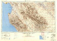
~ Santa Cruz CA topo map, 1:250000 scale, 1 X 2 Degree, Historical, 1955, updated 1955
Santa Cruz, California, USGS topographic map dated 1955.
Includes geographic coordinates (latitude and longitude). This topographic map is suitable for hiking, camping, and exploring, or framing it as a wall map.
Printed on-demand using high resolution imagery, on heavy weight and acid free paper, or alternatively on a variety of synthetic materials.
Topos available on paper, Waterproof, Poly, or Tyvek. Usually shipping rolled, unless combined with other folded maps in one order.
- Product Number: USGS-5637667
- Free digital map download (high-resolution, GeoPDF): Santa Cruz, California (file size: 21 MB)
- Map Size: please refer to the dimensions of the GeoPDF map above
- Weight (paper map): ca. 55 grams
- Map Type: POD USGS Topographic Map
- Map Series: HTMC
- Map Verison: Historical
- Cell ID: 74982
- Scan ID: 302144
- Imprint Year: 1955
- Aerial Photo Year: 1945
- Datum: NAD27
- Map Projection: Transverse Mercator
- Shaded Relief map: Yes
- Map published by United States Army Corps of Engineers
- Map published by United States Army
- Map Language: English
- Scanner Resolution: 600 dpi
- Map Cell Name: Monterey
- Grid size: 1 X 2 Degree
- Date on map: 1955
- Map Scale: 1:250000
- Geographical region: California, United States
Neighboring Maps:
All neighboring USGS topo maps are available for sale online at a variety of scales.
Spatial coverage:
Topo map Santa Cruz, California, covers the geographical area associated the following places:
- Paicines - Alimur Park Mobile Home Park - Blanco - Plantel (historical) - South Dos Palos - Parkfield Junction - Jamesburg - Avenal - Wood Ranch - Tres Pinos - Murray - Ambler Park - Natividad - Cooper - Corporal - Vineyard (historical) - Carmel Highlands - Sargent - Chualar - Cromir - Dunbarton (historical) - Fep (historical) - Shangri La Estates - Hunter-Liggett - Ridgemark - Pacific Grove - Duri (historical) - Aromas - Country Villa Estates Mobile Home Park - Oilfields - Ellicott - Benito - Confederate Corners - Storey - Quail Meadows - Petroleum (historical) - Nashua - Gabilan (historical) - Fort Ord Village (historical) - King City - Aptos - Mission Oaks Mobile Home Community - Amesti - Molus - Allegro Heights - Mendota - Vega (historical) - Del Monte Forest - Panoche Junction - Seacliff - Santa Rita - Rio Plaza Mobile Home Park - Bitterwater - Loma Vista Mobile Home Park - Docas (historical) - Corral de Tierra - Slates Hot Springs - Port Watsonvile - Portola Heights Mobile Home Park - Welby - Spreckels - Ocean Breeze Mobile Home Park - Hamburg Farms - Cabrillo Mobile Home Park - Strongs Mobile Village - Levis - Castle Mobile Estates - Lonoak - Nares (historical) - Soquel - Pajaro - Sycamore Flat - Hudner - Greenfield - Brookvale Terrace Mobile Home Park - Idria - Ripperdan - Italian Swiss Colony - Nuga (historical) - Cannery Row - Surf and Sand Mobile Home Park - New Brighton (historical) - Tony Ziro Mobile Living Mobile Home Park - Majors - Seaside - Old Mill Park Mobile Home Park - East Garrison - Rapetti (historical) - Boronda - Live Oak - Baronet Estates - Metz - Salinas - Larkin Valley - Brito - Hydril - Oak Hills - Spreckels Junction - Robles Del Rio - Cliftwood Mobile Home Park
- Map Area ID: AREA3736-122.2-120
- Northwest corner Lat/Long code: USGSNW37-122.2
- Northeast corner Lat/Long code: USGSNE37-120
- Southwest corner Lat/Long code: USGSSW36-122.2
- Southeast corner Lat/Long code: USGSSE36-120
- Northern map edge Latitude: 37
- Southern map edge Latitude: 36
- Western map edge Longitude: -122.2
- Eastern map edge Longitude: -120


