
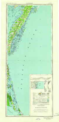
~ Eastville VA topo map, 1:250000 scale, 2 X 1 Degree, Historical, 1961, updated 1961
Eastville, Virginia, USGS topographic map dated 1961.
Includes geographic coordinates (latitude and longitude). This topographic map is suitable for hiking, camping, and exploring, or framing it as a wall map.
Printed on-demand using high resolution imagery, on heavy weight and acid free paper, or alternatively on a variety of synthetic materials.
Topos available on paper, Waterproof, Poly, or Tyvek. Usually shipping rolled, unless combined with other folded maps in one order.
- Product Number: USGS-5631347
- Free digital map download (high-resolution, GeoPDF): Eastville, Virginia (file size: 9 MB)
- Map Size: please refer to the dimensions of the GeoPDF map above
- Weight (paper map): ca. 55 grams
- Map Type: POD USGS Topographic Map
- Map Series: HTMC
- Map Verison: Historical
- Cell ID: 320750
- Scan ID: 189246
- Imprint Year: 1961
- Woodland Tint: Yes
- Aerial Photo Year: 1938
- Datum: NAD27
- Map Projection: Transverse Mercator
- Map published by United States Geological Survey
- Map Language: English
- Scanner Resolution: 600 dpi
- Map Cell Name: Eastville
- Grid size: 2 X 1 Degree
- Date on map: 1961
- Map Scale: 1:250000
- Geographical region: Virginia, United States
Neighboring Maps:
All neighboring USGS topo maps are available for sale online at a variety of scales.
Spatial coverage:
Topo map Eastville, Virginia, covers the geographical area associated the following places:
- Quinby - Bayleys Neck Farm - Keller - Messongo - Crisfield - Port Trinitie - Hill Landing - Bobtown - Smithville - Cardinal Estates - Fairview - Ward - Daugherty - Smith Beach - Macedonia - George Town Sands - Wachapreague - Red Bank - Pastoria - Martins Siding - Kiptopeke - Kitty Hawk - Seaside Mobile Village - Tyler - Bayview - Caffys Inlet Hamlet - Tunnels Mill - Deep Creek - Black Point Landing - Sanderling - Withams - Justisville - Solitude Trails - Sandbridge Beach - Nelsonia - Exmore - Hopeton - Southern Shores - Lawsonia - Metompkin - Stumptown - Shad Landing - Avalon Bench - Onancock - Sigma - Daugherty Town - Poteskeet Village - Savage Town - Westerhouse Woods - Point Harbor - Church Creek Point - Woodstock - Byrdtown - Graysville - Knotts Island - Poyners Hill (historical) - Johnson Corner - Osprey - Carova - Bayside - Miona - Clam - Bridgetown - Jersey - Wild Duck Dunes - Dreamland Mobile Home Park - Mappsburg - Saxis - Crockett Town - Bertha - Lee Mont - Greta (historical) - Campbells Landing - Gulls Flight - Groton Town - Ferguson Mobile Home Park - Oyster - South Chesconessex - Hopkins - Nash Corner - Poplar Branch - Hare Valley - Capeville - Cavalier Park - Howard (historical) - Piggen - Hideaway Cove - Bayberry Bluffs - Croatan Shores - Sandy Ridge - Carolina Dunes - Nassawadox Estates - Wardtown - Waterlily - Trower - Coinjock - Deep Hole - Cedar View - Savageville - Bulls Landing
- Map Area ID: AREA3836-76-75
- Northwest corner Lat/Long code: USGSNW38-76
- Northeast corner Lat/Long code: USGSNE38-75
- Southwest corner Lat/Long code: USGSSW36-76
- Southeast corner Lat/Long code: USGSSE36-75
- Northern map edge Latitude: 38
- Southern map edge Latitude: 36
- Western map edge Longitude: -76
- Eastern map edge Longitude: -75


