
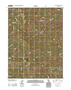
~ Solomon Peak CA topo map, 1:24000 scale, 7.5 X 7.5 Minute, Historical, 2012
Solomon Peak, California, USGS topographic map dated 2012.
Includes geographic coordinates (latitude and longitude). This topographic map is suitable for hiking, camping, and exploring, or framing it as a wall map.
Printed on-demand using high resolution imagery, on heavy weight and acid free paper, or alternatively on a variety of synthetic materials.
Topos available on paper, Waterproof, Poly, or Tyvek. Usually shipping rolled, unless combined with other folded maps in one order.
- Product Number: USGS-5630051
- Free digital map download (high-resolution, GeoPDF): Solomon Peak, California (file size: 26 MB)
- Map Size: please refer to the dimensions of the GeoPDF map above
- Weight (paper map): ca. 55 grams
- Map Type: POD USGS Topographic Map
- Map Series: US Topo
- Map Verison: Historical
- Cell ID: 42035
- Datum: North American Datum of 1983
- Map Projection: Transverse Mercator
- Map Cell Name: Solomon Peak
- Grid size: 7.5 X 7.5 Minute
- Date on map: 2012
- Map Scale: 1:24000
- Geographical region: California, United States
Neighboring Maps:
All neighboring USGS topo maps are available for sale online at a variety of scales.
Spatial coverage:
Topo map Solomon Peak, California, covers the geographical area associated the following places:
- Sulphur Spring - Solomon Peak - Frying Pan - Devils Hole Ridge Trail - Harvey Ridge - Devils Hole - Minnie Lake - Willow Basin Creek - Lazyman Butte Trail - Devils Hole Ridge - Willow Basin - Johnson Headquarters - Hopkins Peak - Thomes Pocket Ridge - The Knob - Lazyman Spring - French Trail - Cedar Basin - Hawk Camp - Ides Cove National Recreation Trail - Thomes Pocket - Hopkins Hollow - Scott Ridge - Lazyman Camp - Harvey Peak - Manzanita Ridge - French Cove - Lazyman Ridge - Grouse Ridge - D Camp - Spring Rock - Hole-in-the-Ground - Thomes Pocket Recreation Site - Robinson Creek - Kingsley Lake - Lazyman Butte - Hammerhorn Mountain - Last Camp - Sugarloaf Mountain - Soldier Trail - Vinegar Peak
- Map Area ID: AREA40.12540-123-122.875
- Northwest corner Lat/Long code: USGSNW40.125-123
- Northeast corner Lat/Long code: USGSNE40.125-122.875
- Southwest corner Lat/Long code: USGSSW40-123
- Southeast corner Lat/Long code: USGSSE40-122.875
- Northern map edge Latitude: 40.125
- Southern map edge Latitude: 40
- Western map edge Longitude: -123
- Eastern map edge Longitude: -122.875


